
Take a sip of wine.
And while you search for the oaky notes and try to pick out hints of citrus, consider too that your glass might, one day, contain a dose of drone data. In other words: in-depth information collected by an Unmanned Aerial Vehicle or UAV.
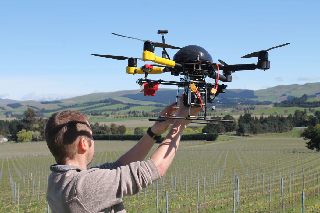
Rob Prileszky prepares to fly the quadcopter at Black Estate Wines. Photo: RNZ / Katy Gosset
Here’s an example: We're in wine country: Waipara, North Canterbury. The neatly planted rows of Black Estate Wines fall away down the hillside before us. And overhead, a small quadcopter buzzes, its multi-spectral eye capturing information that's invisible to mere humans.
This could be a possible future direction for winemakers, using different bands of light to deepen their understanding of plant and soil health.
The wave lengths used are red, green, blue, infrared and an intermediate band between red and infrared, sometimes referred to as "near red" or "red edge". As Kelvin Barnsdale from Canterbury University's Spatial Engineering Research Centre explains:
"Those wave lengths come from the sun but cannot be seen by the human eye."

The quadcopter is fitted with a multi spectral camera Photo: RNZ / Katy Gosset
Each shot from the quadcopter's multi-spectral camera produces five separate images that correspond to the different wave lengths.
"In this case, near infrared is useful because it gives us a measure of plant health and plant stress."
By analysing the ratio of the different bands to each other, the camera can capture credible data that is unaffected by the changing ambient light.
"If we just use the reflected near infrared or red, those levels would change when the sun's out or if it's cloudy: it depends on how much light we're getting from the sun. If we use the ratio then both levels change together." Mr Barnsdale says.
Video copyright: University of Canterbury
Flying the quadcopter is Rob Prileszky who has been exploring possible applications for drones, including for the wine industry.
As we walk the rows at Black Estate, he explains that it's early in the wine season and the canopy is still building up. But he says camera images can help identify which areas are wet and which are dry.
"It could be the soil quality, it could be the irrigation system. There might even be some leaks in the irrigation."
Such information could ultimately be used to influence fertilisation and harvesting decisions. Later in the season, the camera might capture images of leaf development and plant health.
"We can definitely take a look at those in the data and give a very good assessment of which areas are doing better than others."
For every sortie a flight plan is pre-programmed into software on the laptop, the quadcopter launches manually and is then switched to automatic mode. When the drone returns, photos are uploaded and the data analysed.
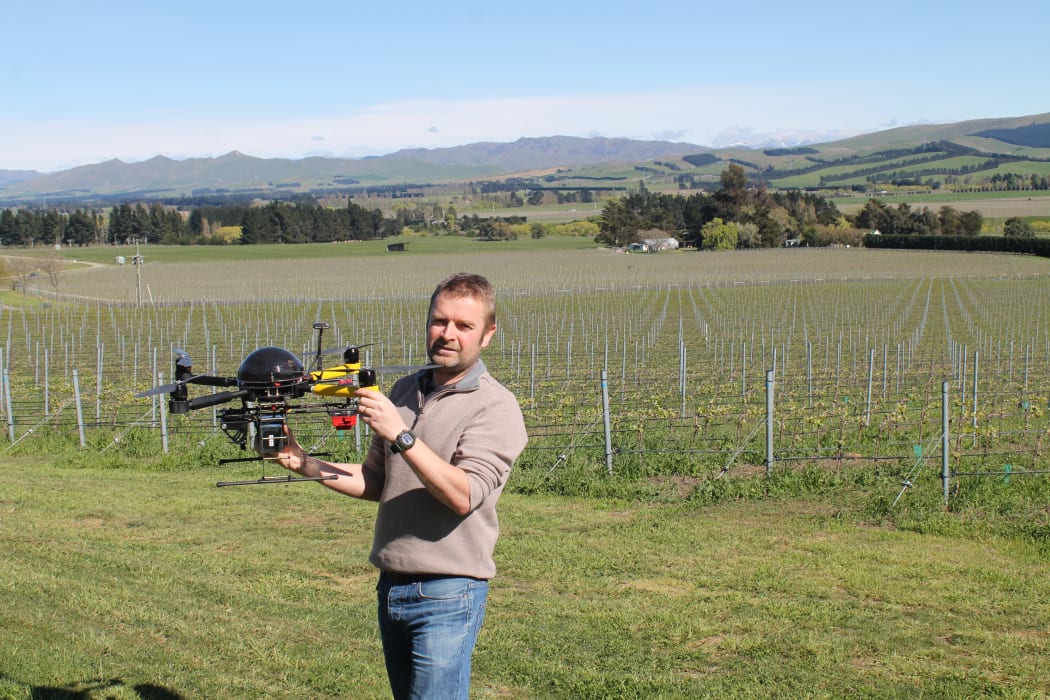
Drone pilot Rob Prileszky. Photo: RNZ / Katy Gosset
"A thousand uses"
Rob Prileszky says the value of drone technology is less about the quadcopter and more about the data it collects.
"From our point of view [the drone is] just another tool and it's about the information you get from it and the business decisions that you can make, based on that information."
He's aware that drones have "some negative stigma" with some people viewing them as "spy tools". But he believes, in time, more businesses will use the information drones can collect.
"We see it as an emerging technology and we also see that there [are] a thousand uses for this technology."
Some examples come from Mr Prileszky's own background in the civil engineering and surveying industries.
"If you think about a highways project or an area for subdivision, that would take days and days for a surveyor to do and be very expensive but a UAV could do that in a day."
Likewise, he believes a drone would make short work of the monitoring and stocktaking duties required by quarries.
"Now you can fly a UAV over and you can measure the quantities in the stock piles. You can do a 3D model and []base it [on] ground co-ordinates so you can insure that the quarry is sticking to its resource consent compliance, in other words, not digging too deeply."
Thermal cameras could also be added to the drone to inspect buildings and electrical installations for heat leaks or to help identify hot spots after a fire.
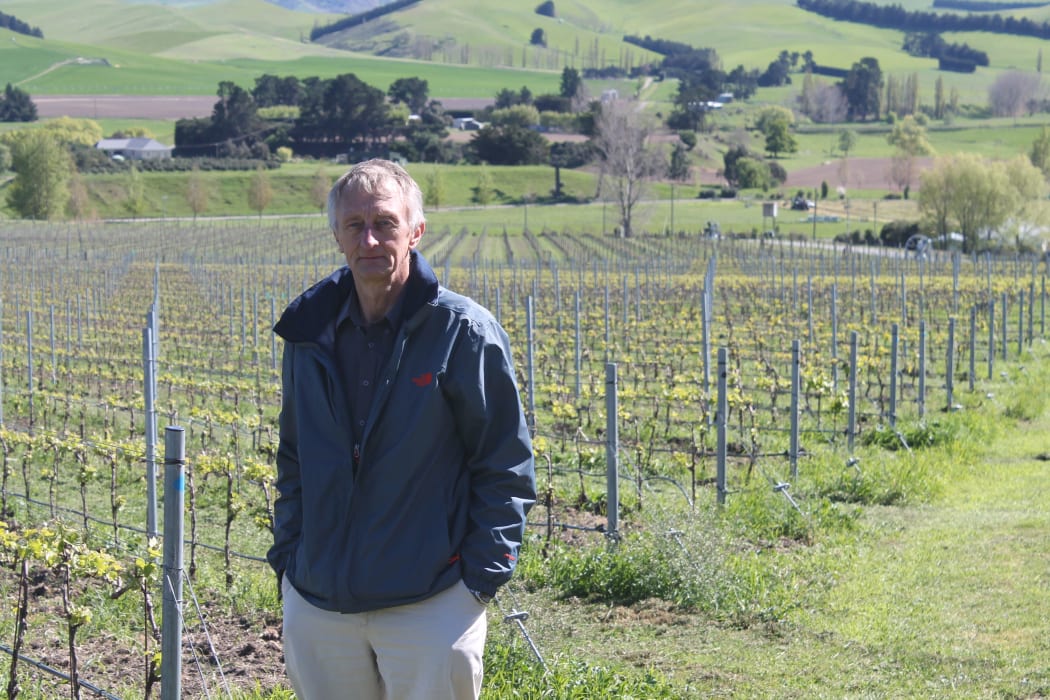
Kelvin Barnsdale from Canterbury University’s Spatial Engineering Research Centre, at Black Estate Wines in North Canterbury. Photo: RNZ / Katy Gosset
Emergency work
Kelvin Barnsdale is also expecting to see more drones in high risk situations.
"I'm looking to develop drones for use in dangerous areas where we don't want the pilot in the aircraft.
These could include inspections of power lines and cliff faces but also [places] where illegal activity is taking place.
"There's areas now where there's terrorist action and it’s getting quite dangerous for pilots to be in aircraft and helicopters: things like animal poachers in Africa. So those dangerous operations, they're a great application for drones, much safer for the operator."
But the UAVs have had their blades clipped a little by aviation rules.
Mr Barnsdale says current laws don't allow drones to fly beyond the visual line of sight of the pilot.
Mr Prileszky says that might limit some business proposals.
"It makes carrying out highway projects very difficult because you've got to split it down into 600 to 800 metre sections. If you're thinking about a 12 kilometre highway that's a lot of unnecessary work when it would just be easier to fly it up and down the alignment."
But Mr Barnsdale has been working closely with the Civil Aviation Authority and is hopeful that, as technology improves, the rules will be relaxed.
"So, if we had a system for detect and avoid so that the drone could detect other aircraft and avoid them, then we could extend the rules to beyond visual line of sight. That would put us well ahead of all other countries in the world."
And that's where the university's new test range comes in.
Drones are very versatile and can be used for many different things. Photo: RNZ / Katy Gosset
The world is watching
Above the remote Kaitorete Spit on Banks Peninsula, lie nearly 100 square kilometres of restricted air space.
It was awarded to the Spatial Engineering Research Centre by the Civil Aviation Authority in 2015 and used for the first time last July.
"When we activate it we can keep all other aircraft out of the airspace so we know, to a great certainty, that there's no risk of collision with any other aircraft."
Mr Barnsdale says the university has already collaborated with Japanese researchers to propose using swarms of drones which would fly over designated disaster areas locating and retrieving information about injured people.
But he says the UAV test range also makes Canterbury attractive to international industries.
"We're starting to be a seen as a great testing ground for new technology."
In January, a driverless car was tested at Christchurch Airport and Mr Barnsdale says New Zealand is developing a reputation for trialling autonomous vehicles.
"We seem to be giving the right message to the world that we're a leader in accepting this new technology for trials."

