After a week of wet, cold weather MetService is forecasting a fine, but frosty weekend for the country.
Showers are lingering about southern Wellington, Wairarapa, and Hawke's Bay through to Gisborne, but these are expected to clear overnight, leaving clear skies.
Meteorologist Nick Zachar said frosts were expected overnight, with Hamner Springs expecting a low of minus 12 degrees - equal to the lowest official temperature recorded there.
In the meantime, a front currently in Australia should reach New Zealand by Tuesday.
Mr Zachar said Australian media were describing the system as the strongest cold front in five years.
"As that moves over the Tasman the air mass is going to be modified a little bit, so it won't be as extreme when it gets to New Zealand but we are expecting some quite active weather - fairly widespread rain and shower activity across the South Island and then the North Island from late Tuesday and Wednesday and even Thursday."
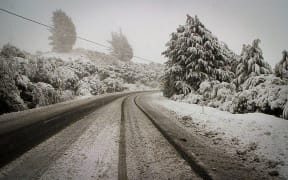
Meanwhile, the Waiouru Military Camp has been busy rescuing stranded motorists and accommodating people caught out by the weather.
The commandant of the camp Major Patrick Hibbs said about 60 people stayed in the camp's barracks overnight.
He said once the police blocked State Highway 1 because of snow and ice, they helped get cars off the road and soldiers helped people to safety.
He said one stranded family stayed at his house.