Severe weather warnings for many parts of the country will stay in place until tomorrow, says MetService.
Meterologist Peter Little said there were road warnings in place for parts of Southland and eastern Otago after snow fell to low-lying areas.
Mr Little said there was also a risk of severe thunderstorms for the Kāpiti area, north of Wellington, including small tornados.
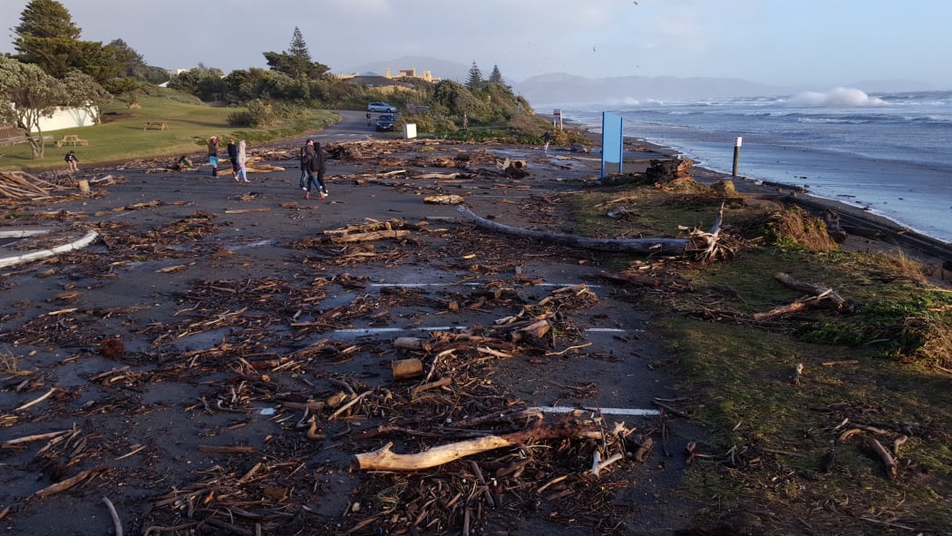
The car park at Raumati beach on the Kāpiti Coast showing the effects of high seas and gale force winds. Photo: Simon Dickinson
He said the coast was being battered by the sea.
"There's been a very, very strong westerly flow across central New Zealand and that's also developed some large swells across the Tasman Sea and the combination of those strong winds and these swells are certainly pushing some large waves up on to the beaches there."
NZ Transport Agency said all drivers travelling in the West Coast and crossing the alpine passes should carry chains.
Snow in Southland
Southland farmers said the first snowfall of the season had come unusually late, and down to a low level.
Between 10 and 20 centimetres of snow has fallen on Southland in the past eight hours.
Gore sheep farmer Alison Deaker said it was a heavy fall and wasn't forecast - but farmers were coping.