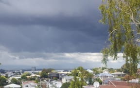
Wild weather is expected to batter the top of the North Island today as the region braces for another day of thunderstorms, hail and heavy rain.
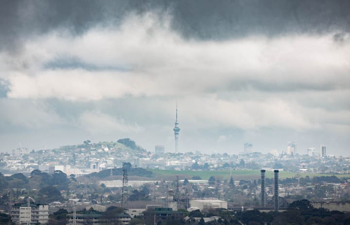
Photo: RNZ / Cole Eastham-Farrelly
MetService said nearly 1000 lightning strikes hit areas between the Bay of Islands and Waikato yesterday afternoon, while parts of Auckland had dumps of rain up to 23mm an hour.
Forecaster Allister Gorman said he expected another day of thunderstorms, but this time the line of fire moves out west.
The Waitakere Ranges and Glenbrook could get dumps of rain, as well as the west coast of the Waikato and Northland.
Towering cumulus cloud well to the north of Auckland again this morning ... an early indicator that a few more thunderstorms ⚡ are possible in the upper North Island today. pic.twitter.com/gkmlpeB3m8
— NIWA Weather (@NiwaWeather) November 14, 2017
Niwa Forecaster Ben Noll told Morning Report thunderstorms were more common in the "shoulder seasons" (autumn and spring) because of the instability in the atmosphere caused by the warmth from the sunshine meeting "winter-like" cold air from the south.
"Thunderstorms have three ingredients that are essential. It's moisture, instability in the atmosphere and the trigger.
"We have an airflow from the Pacific Ocean, that's pretty moist ... we have a little disturbance in the atmosphere; and then the trigger, known as the sea breeze, so winds from the east and the west converge over the land and that is what sets everything into motion."
Mr Noll said although the thunderstorms would not be as widespread today as they were yesterday, more thunder, lightning and potentially hail was on the way for the afternoon.
"Don't let your guard down just yet."
He advises to take care when driving today, especially in the upper North Island.