Early warnings are being sounded for parts of the North Island and the upper South Island, which could be in the path of a weakening Tropical Cyclone Gita.
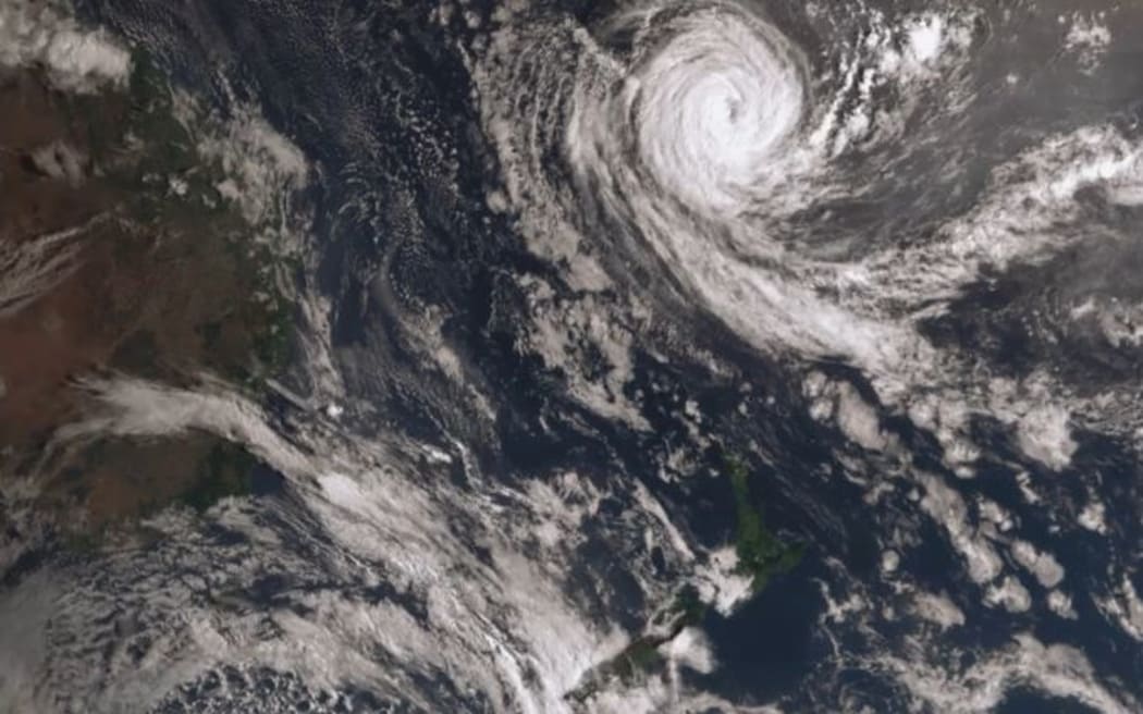
This satellite imagery shows Tropical Cyclone Gita north of New Zealand on Friday morning. It is expected to move south of New Caledonia overnight tonight. Photo: Twitter / @MetService
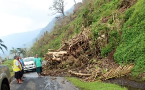
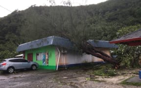
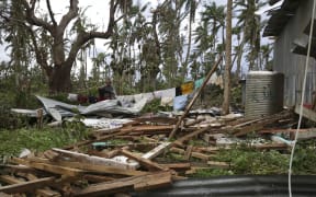
The storm, now a category three, has caused havoc in the Pacific, destroying house, flooding homes and businesses knocking out communications in Samoa, Tonga and Fiji islands.
RNZ Pacific's correspondent in Samoa, Autagavaia Tipi Autagavaia said that compared to Tonga, Samoa came off relatively unscathed from the cyclone.
He said most of the damage in Apia is the result of flooding by the Vaisigano River.
Mr Autagavaia said one of the most seriously flooded areas is around the iconic Aggie Grey's Sheraton Hotel which has been closed as a result.
The cyclone is now heading to New Caledonia where it is expected to pass on Saturday night before veering into the Tasman Sea.
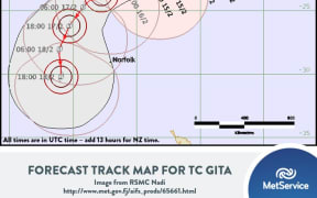
MetService said Gita was likely to head towards New Zealand early next week, bringing heavy rain and strong winds to parts of the country on Tuesday and Wednesday, but it is still too early to predict the path it might take.
#CycloneGita now getting into @niwa_nz in-house modelling range. Here's our NZLAM wind gust forecast through to 7 am Monday.
— NIWA Weather (@NiwaWeather) February 15, 2018
By Sunday, we expect #TCGita to be within our NZCSM ultra high (1.5 km) resolution range which will provide high detail of potential impacts ~Chris pic.twitter.com/FntzxvmRSV
NIWA meteorologist Chris Brandolino said it would be a fast-moving ex-tropical cyclone.
"New Zealand looks like it will get an impact, but the question remains over whether it will be more of a central North Island event, or is it going to be more of an upper South Island kind of event.
"The more reliable models are pegging the Kāpiti Coast up to the Taranaki region, east to southern Hawke's Bay and down to the Wairarapa but that doesn't exclude other areas," he said.
Nerd alert!
— NIWA Weather (@NiwaWeather) February 15, 2018
Research has show (https://t.co/ObccmPqMsH) significant rain can occur ahead of main heavy rain shield with tropical cyclones & increase flood risk.
This is called a predecessor rain event (PRE) & is evident on 1 global model. Note: location may change. ~Chris pic.twitter.com/O98Qp7a0Rr
The Nelson-Tasman emergency management group is already on standby. The council-run group said given the damage caused to the region from two large recent storms, it wants to advise residents early to be ready.
A Nelson City Council spokesperson said current predictions show that the cyclone may track over the lower North Island and upper South Island on Tuesday.
"Although it may lessen in severity, it could still bring with it strong winds, heavy rain and storm surges. Forecasters are warning that this may be a significant weather event."
The emergency management group is advising residents affected by the flooding in either of the last two events, to take precautions now to protect their property.
"Tasman District Council and Nelson City Council do not provide sandbags, and so residents are recommended to make their own arrangements."
Campers, mariners and other people who live and work along the coast should pay particular attention to forecasts and prepare accordingly. Residents are also being reminded to make sure their emergency supplies and plans are up to date.
Mr Brandolino said anyone from the upper South Island to the central North Island needed to pay attention to local forecasts over the next few days.