A new study of Lake Tekapo could help scientists understand the tsunami risk of New Zealand's big lakes during earthquakes.
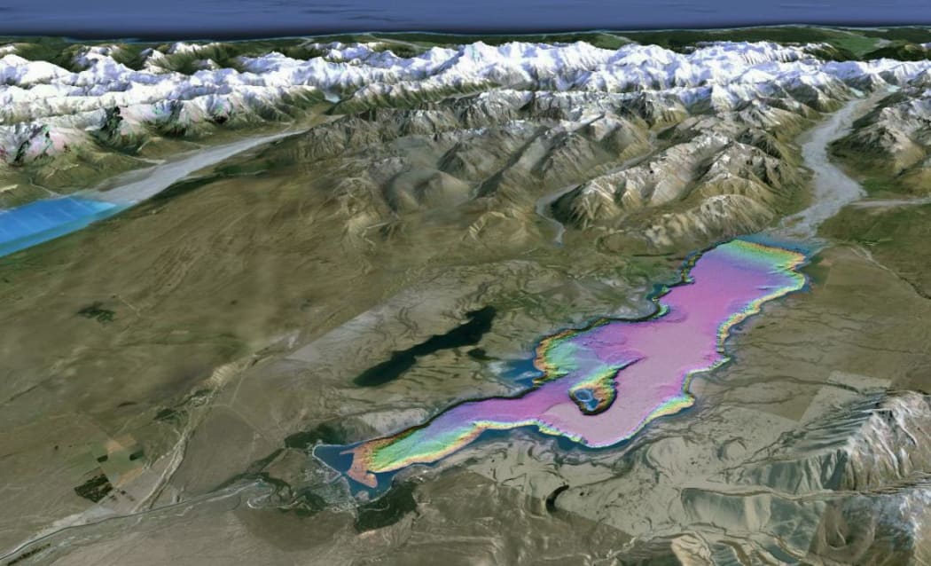
Mapped image of Lake Tekapo's lake bed. Photo: NIWA
A pilot project led by NIWA mapped the lake using sonar and showed a large amount of sediment building up, which can make the steep sides of the lake and the mountains next to it prone to collapse.
Marine geologist Dr Joshu Mountjoy led the two year project, and said a tsunami in Lake Tekapo could cause waves as high as five metres.
"We can have landslides failing on the sides of the lake or we can have them coming from mountains coming into the lake, or from deltas where there's a lot of sediment build up.
"At the moment we have been able to see that there's been quite a few landslides happen in the past and we can model a tsunami generated by those."
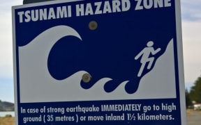
He said there was not a lot that can be done to mitigate any risk. However, he said that with the coastal environment, if people feel a long or strong earthquake they should move to higher ground and encourage others to do the same.
The study was published by the Geological Society of London and was presented at an international conference on underwater landslides where other researchers presented historical example of large tsunamis in lakes.
"A really interesting aspect of the results from this study is that there is clear evidence that many landslides have occurred at the same time and we believe this has happened during large earthquakes. We cannot be sure if this is an Alpine Fault earthquake or something local, but it does mean there may be a natural warning if such an event happens again."
Dr Mountjoy said the pilot study can be used to inform research into the tsunami hazards of other large New Zealand lakes such as Wakatipu, Wanaka and Taupo.