
A drone has been used to capture images of a slip on State Highway 35 in Eastern Bay of Plenty.
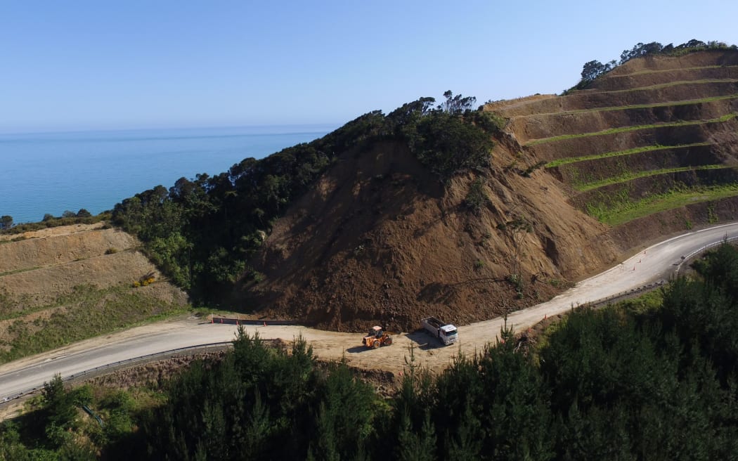
A slip on State Highway 35 in Eastern Bay of Plenty. The image was captured by a drone. Photo: Supplied: NZTA
The 130-metre wide slip, which occurred two weeks ago at Maraenui Hill, between Opotiki and Te Kaha, has reduced the road to one lane.
The Transport Agency said the cliff face above the road remained unstable.
NZTA's Bay of Plenty highways manager, Niclas Johansson, said the drone gave a bird's eye view of the top of the slip and the surrounding cliff without putting people at risk.
He said contractors were working hard to get two temporary lanes open.
Mr Johansson said some slip material had been used to widen the road and create a new lane to allow traffic to go through safely.
"Geotechnical experts have been investigating the site, using the drone to get a bird's eye view of the top of the slip and the surrounding cliff safely," he said.
"We expect to have an understanding of the situation in the next week or so, then we will start looking at the best long term solutions."
One lane is open with stop/go traffic management in place. Contractors are working to clear the slip to create temporary access and the aim is to have two lanes open to traffic this weekend.
Mr Johansson said the agency was doing everything possible to keep the road open.
"Contractors are monitoring the site 24 hours a day and safety is our top focus."
The Transport Agency advises motorists travelling on SH35 to check road conditions before leaving home.

