More than a month after the area was hit by major flooding, landslips continue to block access on Taranaki and Whanganui farms, and some farmers have not seen their stock in weeks.
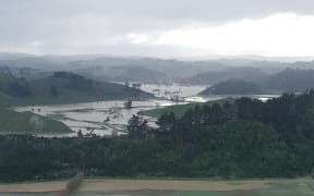
An aerial view of South Taranaki township Waitotara during the height of June's flooding. Photo: SUPPLIED
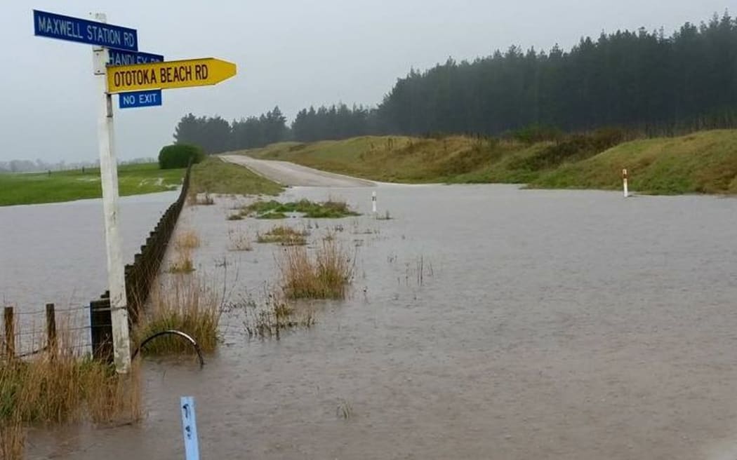
Heavy rain across the western and lower North Island in June caused slips, erosion and flooding.
Roads, bridges, fences and farm land have been washed away and communities are facing many months of cleaning up.
Marcia Paurini - a Taranaki Rural Support trustee - has been gathering information on access and damage to land, stock numbers and feed situations.
She said the ground was still too wet in most areas to use diggers or ride quad bikes.
"I was talking to a young farmer up the back of Stratford who has to ride his horse to get over to his stock. And I know, up the top of the Waitotara Valley, they still haven't seen their stock for a few weeks and are just hoping that they're grazing well.
"That's one of the dilemmas for the Rural Support Trust: how do we move the animals if we can't get to them, and how do we get feed into them?
That's some of the analysis that will come out of Waitotara Valley this Friday afternoon."
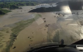
The rain caused slips, erosion and flooding in Taranaki, Whanganui (pictured) and other parts of the western and lower North Island. Photo: Supplied/ Wanganui.com
Ms Paurini said she believed the devastation caused by the weather was a lot worse than the medium-scale adverse event that was declared.
"From what we've seen and what we're hearing, the cost inside the farm gates is higher than what is recognised at the moment.
"So we just want to gather the data about that - what is the exact kilometres of fences out, what is the amount of hectares that have been lost to silt and erosion, and what are the impacts of that long-term?
She said the damage in Taranaki could be mapped from Urenui in the north right down to Patea in the south, with most of the hill country between the two affected.
Clean-up continues in Waitotara Valley
Meanwhile, in Southern Taranaki, a small rural school at the top of the Waitotara Valley is now back to normal after being closed for about two weeks after the flood.
Ngamatapouri School is located 43 kilometres up Waitotara Valley Road, upstream from the village.
Principal Michael Bieleski said most of the 11 pupils did not have road access to get to the school for about two weeks, and many of their parents were the ones working to initially clear the slips off the road.
He said there was little to do but watch when the river started rising.
"The water came up very high, it came up to our bridge which crosses the Waitotara River, just across from the school. Logs were coming down, huge rafts of logs were coming down and smashing into the side of the bridge and we were concerned about the bridge being destroyed, which would have been disastrous - but fortunately it survived.
"The river comes up very fast when it floods and goes down very fast, but it left an incredible amount of silt, so when it went down we had metres of silt on our driveway, so we were stuck ourselves at the school house."
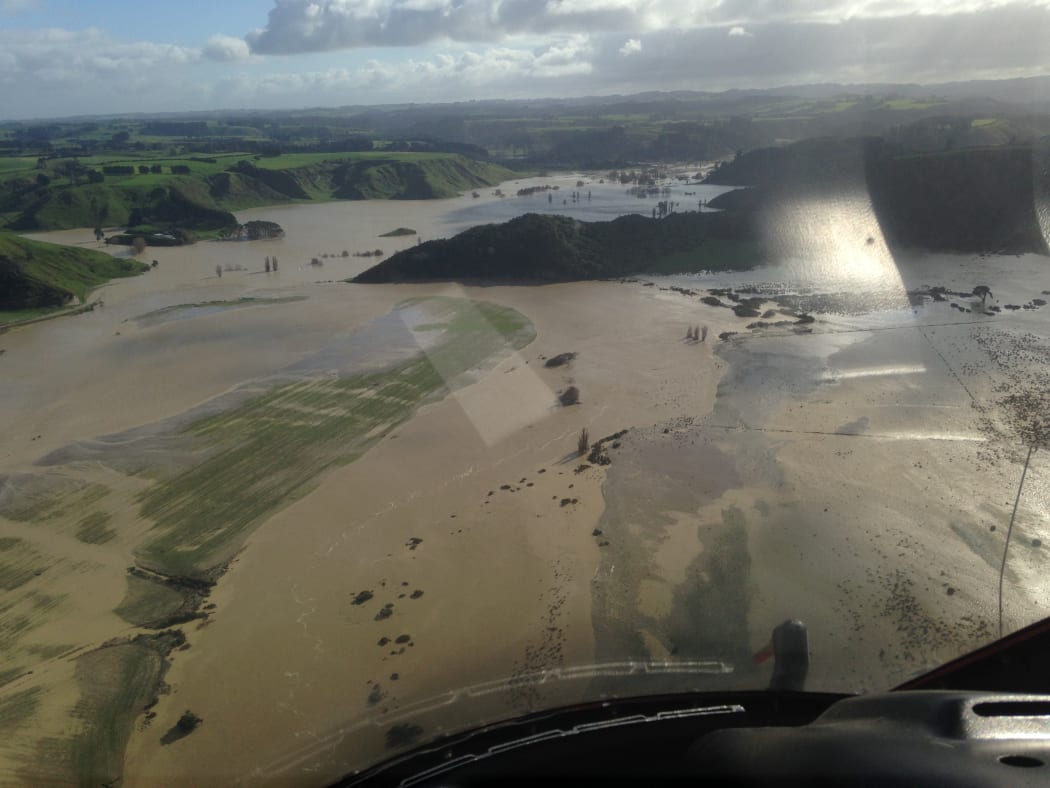
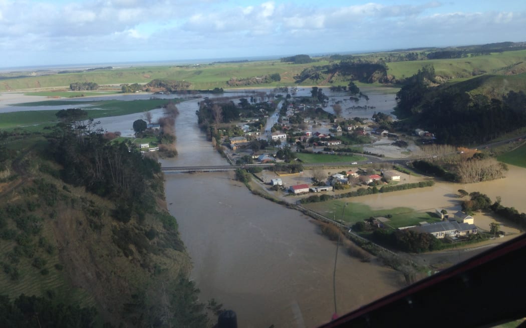
The Waitotara Valley was among areas worst affected by the floods. Photo: SUPPLIED
Mr Bieleski said the local iwi, Ngā Rauru, were quick to step in and help the community.
"They actually helicoptered in a one tonne diesel generator and we wired that into the community hall and into the school.
"That gave the people around the community some power and electricity and got the freezers going in the community hall... We were able to share the freezer in the hall, so we're really thankful for the local iwi helping out there."
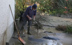
Mr Bieleski said the clean-up of the village and roads would take months.