
Vanuatu Met Service is forecasting that the tiny island of Erromango in Vanuatu's southern Tafea Province will be the worst hit by tropical cyclone Pam.
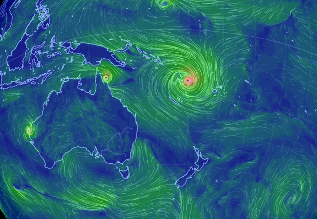
Animation showing Cyclone Pam's size and wind flow, based on supercomputer forecasts. Photo: earthnull
The category 5 super cyclone is travelling in a south westerly direction and will be in the vicinity of the capital Port Vila by 5:00pm local time.
UNICEF Pacific Communications Specialist Alice Clements is in Port Vila and has been going around the capital looking at preparations and talking to people.
She says finding adequate shelter for people is the biggest concern.
"The town centre is deserted it is entirely boarded up. People are in a hurry whereever they are going. Fundamentally there is a problem with the lack of suitable shelters here. People are scared and they are not entirely confident that the shelters that they are in are appropriate to see them through the storm. That is an issue of real concern."
Alice Clements says winds have strengthened over night and rains have intensified.
Winds at the centre of Tropical Cyclone Pam are estimated to be as high as 215 kilometres an hour as the category five system continues to slowly move to the east of the country
In the latest warning issued an hour ago, Pam was located near 15.2 degrees south, 169.4 degrees east inching closer to Maewo in Penama province, in the country's north at about 12 kilometres an hour.
Destructive winds and very rough seas are forecast for the entire country, along with torrential rain that is likely to cause flooding and landslides.
Vanuatu's National Disaster Management Office says Red Alert is now current for Torba, Sanma, Penama and Malampa provinces.

