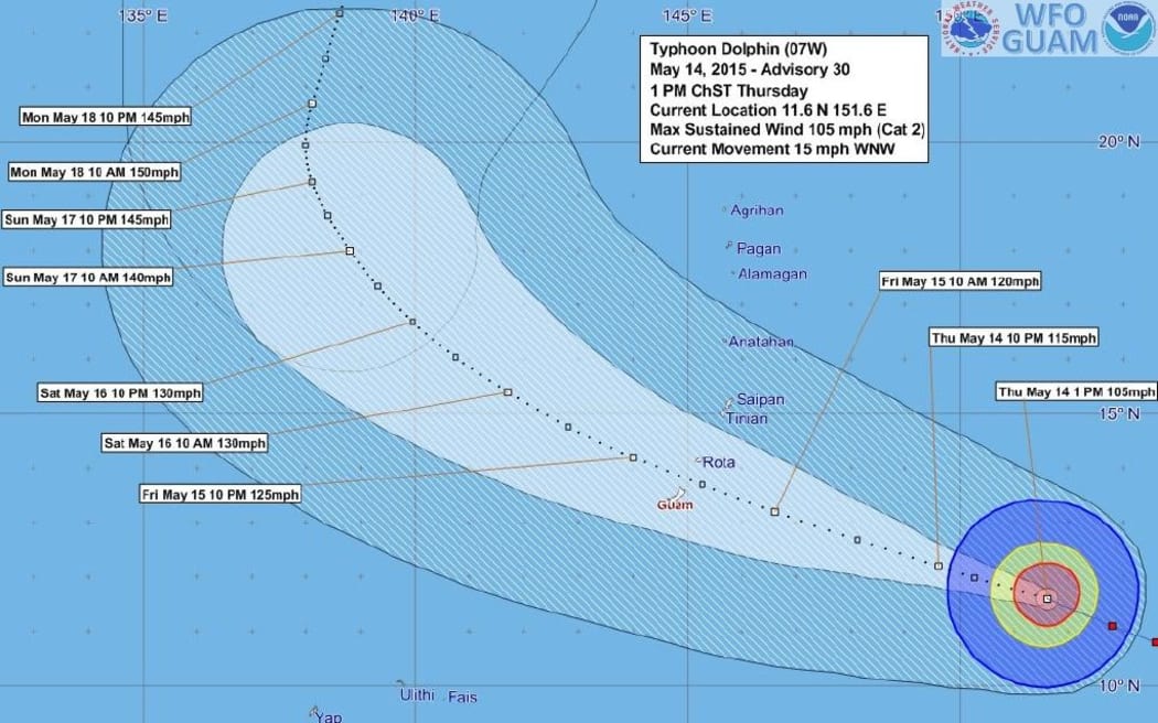
The Forecast Track and Uncertainty Graphic for Typhoon Dolphin, which is heading towards Guam Photo: US National Weather Service
Authorities on Guam and the Northern Marianas are preparing for the arrival of typhoon Dolphin tomorrow, which forecasters say could be the strongest to hit the Marianas since 2002.
A meteorologist with the US National Weather Service on Guam, Mike Middlebrook, says the typhoon is about 700 kilometres off the coast of Guam with winds of up to 144 kilometres an hour at its centre.
Mr Middlebrook says the typhoon is gaining strength and is expected to pass between Guam and the CNMI island of Rota tomorrow afternoon with winds of close to 177 kilometres an hour.
"A very slight shift could bring the maximum winds over land, over one of the islands, and it's only about a 40 mile separation [between Guam and Rota] so if it goes right through there will still be typhoon-force winds in both places."
The Governors of both Guam and the Northern Marianas have advised people to be prepared, and ensure they have enough food, water and fuel.