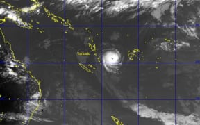
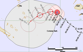
The category four Severe Tropical Cyclone Ula is tracking in a southerly direction close to Vanuatu's southern islands.
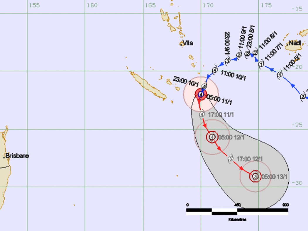
Map tracking Cyclone Ula Photo: Vanuatu Met Service
Early this morning it was situated 160km south southeast of Aneityum and 250km south southeast of Tanna.
On its current path it could hit the same region devastated last March by Cyclone Pam which killed 11 people, left tens of thousands homeless and wiped out entire food crops.
Winds close to the centre are estimated at 165km/h and the Vanuatu National Disaster Management Office is advising that a 'Red Alert' is still in effect for Anietyum Island, in Tafea province.
The NDMO met with aid agencies yesterday and Operations Manager Peter Korisa said it gave his office an idea of which aid agencies were working where.
"There are some societies or NGO that have their own workers on those islands and it's another resource we can capitalise on, and we can use them to provide a safe option and useful information we need," Mr Korisa said.
On Sunday, residents in Tafea province were feeling the effects of tropical cyclone Ula.
Vanuatu Meteorology services lead forecaster Fred Jockley said he had spoken to people on Aneityum, Futuna, and south Tanna.
"People are calling in and telling us that yes, they are receiving strong winds already, and people from Futuna have gone out to tighten their houses, local houses in Futuna."
Mr Jockley said some village chiefs in the province had called local fishermen into shore, and had also warned people not to go out to sea.
New Caledonia has now issued a cyclone alert level for the island of Mare.