
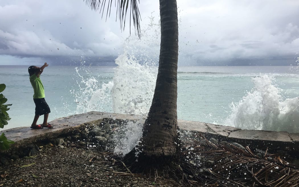
In this photo from last month's peak high tide in Majuro, a local youngster reacts as king tide-driven waves wash over a seawall on Majuro. Significantly higher tides are anticipated this week. Photo: RNZI / Giff Johnson
King tides have been building in height since Thursday around the Marshall Islands, with ocean inundation anticipated today through Tuesday at peak tide periods.
"Major inundation possible inside the lagoon this evening through Tuesday night," warned the Marshall Islands National Weather Service in a forecast issued on Saturday morning.
"We're on stand-by through Tuesday," said public works minister Tony Muller of preparation for possible ocean flooding on Majuro Atoll, the capital that has a population of about 30,000. Heavy equipment, including bulldozers, is being pre-positioned at critical locations so emergency crews can respond quickly in the event of flooding of roads or housing areas, he said.
The single road along the 30-mile (48km) length of this coral atoll that is barely a metre above sea level is often blocked during inundation events by coral, rocks, sand and rubbish tossed up by waves.
The government National Disaster Management Office is on high alert, using its mass text messaging system for the first time on Friday to issue a high tide advisory, alerting residents that "inundation is very likely" through Tuesday.
January and February are when the Marshall Islands sees its highest tides of the year.
The United States National Weather Service in Guam issued an advisory on Saturday morning warning of the possibility of "major inundation" over the next four days of king tides.
"From this evening to Tuesday evening, major inundation of one to two feet is possible, especially during high tides inside the lagoon along north facing shores near the airport eastward to west facing shores near the post office," the weather service warned.
Disaster preparedness officials have positioned sand bags in some areas that lack shoreline protection and are prone to flooding during peak high tides. But even with seawalls, many of the lowest areas on the atoll flood when king tides hit.

