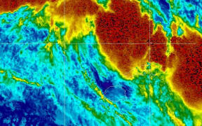
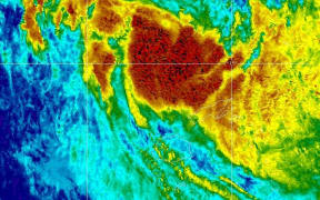
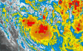
Fiji is on alert for more flooding as Cyclone Mona moves near the eastern tip of its second biggest island, Vanua Levu, bringing heavy rain.
Currently tracking east-southeast at about 17 kilometres an hour, Mona is expected to skim past Vanua Levu without making landfall late tonight and then angle southeastwards through Fiji's Eastern Division.
According to the Fiji Met service, Mona was then expected to track south to the Lau Group, before eventually heading southwest out of the Fiji group by late Tuesday.
The category one storm has been packing winds gusting up to 120km/hr through Sunday, but has brought about heavy rainfall across much of the country already, leaving a number of roads closed by flooding and slips.
At 7pm local time, Mona was located around 160 kilometres northeast of Labasa, or 90 km north-northeast of Udu Point.
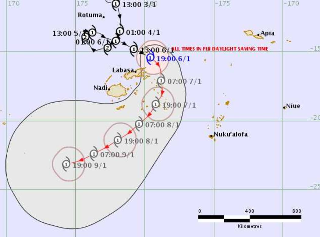
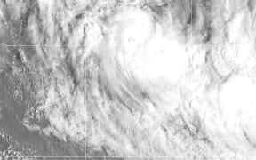
Tracking map for Cyclone Mona, issued 0749 UTC Sunday 6 January 2019. Photo: Fiji Met Service
A forecaster with the met service, Sakeasi Rabitu, confirmed there had been significant flooding today on Vanua Levu, as well as a number of landslides.
He said the southeasterly onshore flow had also brought a lot of rain to the eastern part of Fiji's main island, Viti Levu, further to the west.
Fiji's Disaster Management Minister Jone Usamate said the public had been well advised on Mona's expected path, while all relevant agencies in the northern division were on alert.
Mr Usamate said the main concern relateds to the impacts of heavy rain which Mona was bringing.
"We're keeping close track of the rivers, and the potential areas for flooding. We have a high tide at 9pm tonight. We'll be on alert for those things," he explained.
"But a general advisory has been sent out to everybody about what they... they need to take precautions. So people have been well advised."
Earlier, Senior Forecaster Amit Singh said the projected track had deviated slightly from this morning's forecast.
"The forecast this morning was for it to come very close to the eastern tip of Vanua Levu but looking at our weather imaging now it looks like it will past just east of that point and head towards or very close to Taveuni, to Lomaiviti group and passing just east of Kadavu," he said.
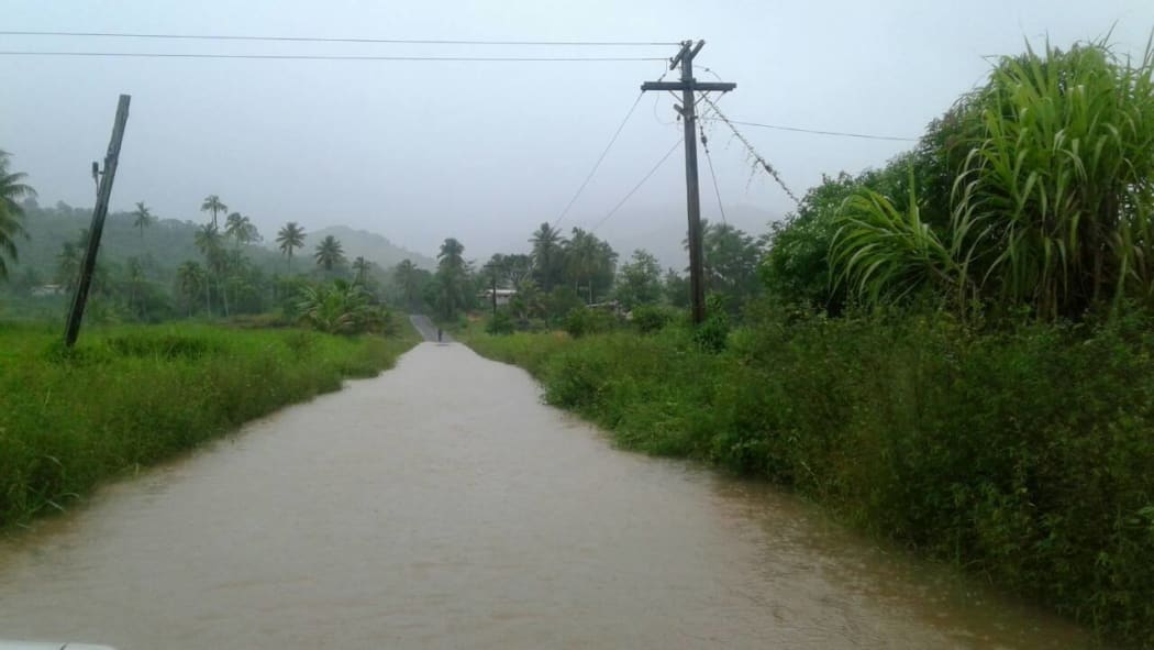
A road is closed because of flooding Photo: Fiji Roads Authority
Cyclone Mona has hoevered around Fiji waters since Thursday, initially avoiding the northern island of Rotuma before heading out to open seas to the west.
However the storm, which became a category two cyclone before losing intensity, then looped back around and made its way towards Fiji's main islands of Vanua Levu and Viti Levu.
Mr Singh said although erratic, it wasn't a particularly strange phenomenon.
"It depends how the systems are being steered by the atmosphere that is close," he said.
Local authorities have warned people not to be complacent and to make sure they are prepared for the storm.
Earlier the head of the National Disaster Managment Office, Anare Lewiniqila, said he expected flooding to be the greatest issue due to the heavy rains brought by Mona to the already sodden country.
As the storm closes in, hundreds of people have already sought shelter in one of 15 shelters that have been opened by the National Disaster Management Office.
Heavy rain and flooding is expected to have affected a region where a lot of land is used for agricultural, particularly sugar cane farming.
Domestic flights and sailings have been suspended and at least 33 roads across the country have been closed due to flooding or slips.
The Fiji Roads Authority said people should still exercise extreme caution and avoid crossing flooded areas.