

In Porirua, in the lower North Island, small urban streams begin life in shady forested headwaters. From there they are channelled into underground pipes, as they flow beneath roads, light industrial zones and expanding suburbs. When they eventually reach the harbour, the streams are carrying sediments and contaminants gathered on the way.
Over the hill in Wairarapa, rural streams flow across grassy farmland stocked with sheep and dairy cows. Carrying nutrients and sediment the streams join big rivers that flow into large lakes.
Two very different catchments, with different challenges facing their freshwater. Which is why Greater Wellington is enlisting the help of locals to find out what the communities are prepared to do to make that water cleaner and healthier.
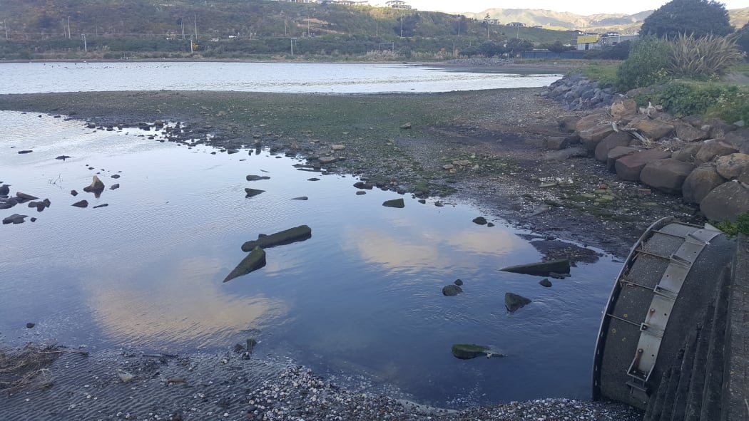
Urukahika Stream arrives in the Onepoto arm of Porirua Harbour via a pipe (right). State Highway 1 and the main trunk railway run alongside the far side of the harbour. Photo: RNZ / Alison Ballance
Subscribe to Our Changing World for free on Apple Podcasts, Spotify, Stitcher, RadioPublic or wherever you listen to your podcasts.
Te Awarua o Porirua, or Porirua Harbour, is the largest estuary in the lower North Island. An important fish nursery that was once home to rich cockle beds. The two arms of the harbour – Onepoto and Pauatahanui- and their surrounding wetlands and forests used to be a food basket for Ngati Toa.
Today, it carries the legacy of decades of development in the surrounding catchment, because whatever happens upstream eventually finds its way to the harbour.
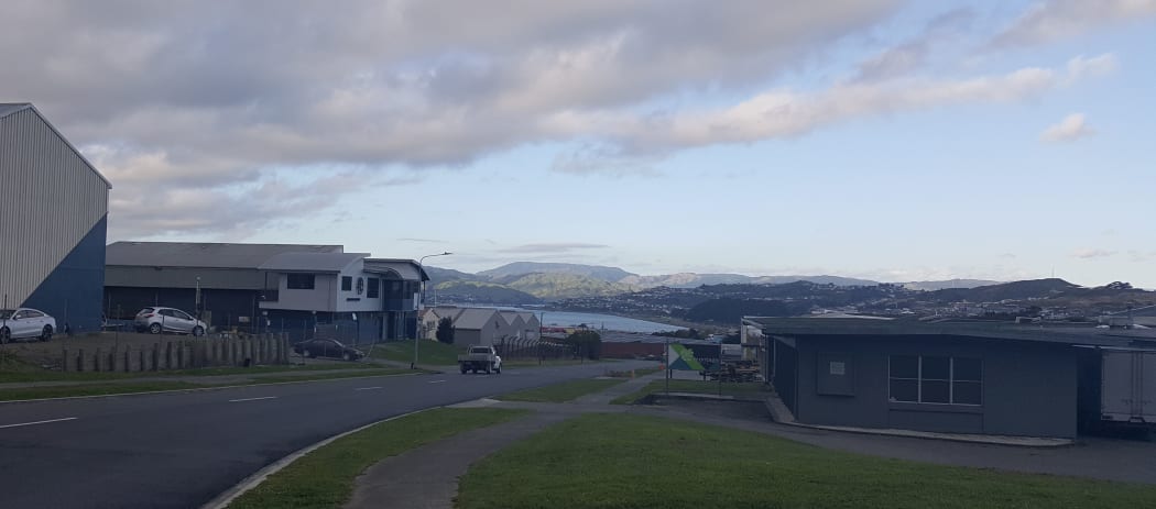
Porirua Harbour, in the distance, is at the receiving end of all freshwater runoff in the catchment, including urban wastewater runoff from houses and roads. Photo: RNZ / Alison Ballance
State Highway 1 and the main trunk railway line run along reclaimed land on the eastern shores of the Onepoto arm of the harbour. Copper and zinc from car brakes and tyres wash off the busy highway into the harbour, creating hotspots of heavy metal contamination.
The surrounding catchment is covered in houses, light industrial and commercial areas, farms and pine plantations. Large new subdivisions regularly appear.
One of the largest roading developments in the country – Transmission Gully – is partway through construction. It carves a wide swathe of bare ground for tens of kilometres across what were once green fields.
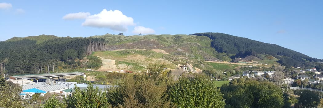
Roadworks for the Transmission Gully section of SH1 run through the Porirua catchment, which includes extensive suburbs, as well as light industrial and commercial areas. Photo: RNZ / Alison Ballance
As a result of many decades of development, sediment has been washing off the hills much faster than it used to. The mud has smothered the bed of the harbour, and cockle populations are now slowly recovering after mass die-offs caused by too much silt.
Faecal contamination, from an aging sewage system as well as livestock runoff, causes alarming spikes in levels of harmful E.coli bacteria.
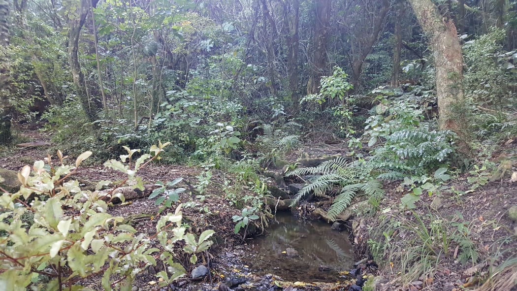
The headwaters of Urukahika Stream are in a shady forest, next to a popular walking track to Colonial Knob. Photo: RNZ / Alison Ballance
Streams, which have their beginnings in small patches of sheltering forest high in the surrounding hills, soon find themselves exposed to full sun as they cross open pasture and or disappear into pipes which run for kilometres underground. The water gathers contaminants on its journey through farmland and township before eventually disgorging it all into the harbour.
When it rains, vast volumes of storm water pours off roofs and roads in the surrounding suburbs, gathering rubbish and contaminants on its headlong rush to the harbour.
All in all, it’s a common story that plays out in many places around New Zealand.
So what can be done to make things better? To make the streams and harbour clean and swimmable, healthy and liveable again?
A group of Wellington citizens have been working together, and consulting with experts as well as the community, to come up with a plan to better manage freshwater in the Porirua catchment and restore the health and mauri of the estuary.
Te Awarua-o-Porirua whaitua committee was set up three years ago by the Greater Wellington Regional Council. It is part of their response to the National Policy Statement for Freshwater Management which provides direction on how local authorities should carry out their responsibilities under the Resource Management Act 1991 for managing fresh water.
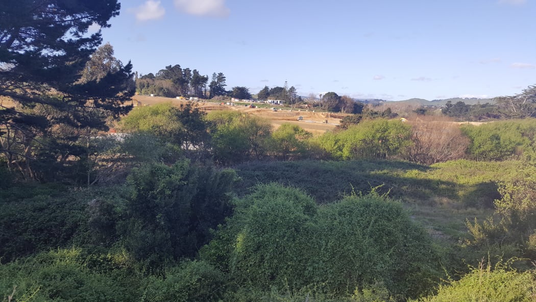
When the Keneperu Landing subdivision is completed, Mitchell's Stream (hidden by weedy bushes in this photo) will be restored with new riparian plantings to provide shade. Photo: RNZ / Alison Ballance
Greater Wellington’s whaitua committees
Greater Wellington has set up five Whaitua committees. These are groups of local people tasked with recommending ways to maintain and improve the quality of our fresh water.
Whaitua is the Māori word for space or catchment, and each whaitua is organised around a catchment and operates on different timeframes.
The Ruamāhanga Whaitua Committee, which covers southern Wairarapa, finished its Whaitua Implementation Programme in August 2018. Their report describes the ways people from the catchment want to manage their water now and for future generations through a range of integrated tools, policies and strategies.
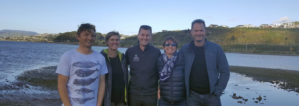
Te Awaroa o Porirua Whaitua Committee members Stu Farrant and Warrick Lyon (far left and right), with Paula Hammond, Mark Heath and Megan Oliver from Greater Wellington Regional Council. Photo: RNZ / Alison Ballance
Te Awarua-o-Porirua Whaitua was established December 2014, has completed research and consultation, and plans to develop and write its recommendations within the next few months. Te Awarua-o-Porirua Whaitua is also part of a Porirua Harbour and catchment programme run by Porirua City Council.
The Wellington Harbour and Hutt Valley Whaitua is currently recruiting members. The Kāpiti Coast Whaitua and Wairarapa Coast Whaitua are yet to be organised.
What other councils are doing
Other regional councils in New Zealand are taking their own approaches to meeting their freshwater management obligations.
In 2017, the Land and Water Forum delivered a report to government on issues relating to the National Policy Statement for Freshwater Management.
More Our Changing World stories from Porirua Harbour
Tracking rig sharks in Pauatahanui Inlet with marine biologist Warrick Lyon.
A community cockle count in Pauatahanui Inlet is a long-running citizen science project.
Surveying rig sharks in Pauatahanui inlet.

