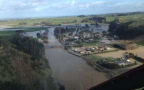
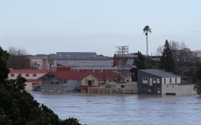
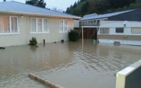
Flooding has closed a number of roads in the lower North Island, while power is out in some areas and some houses are without water.

Cars on State Highway 3 waiting to get into Whanganui. Photo: RNZ / Tom Furley
Evacuations
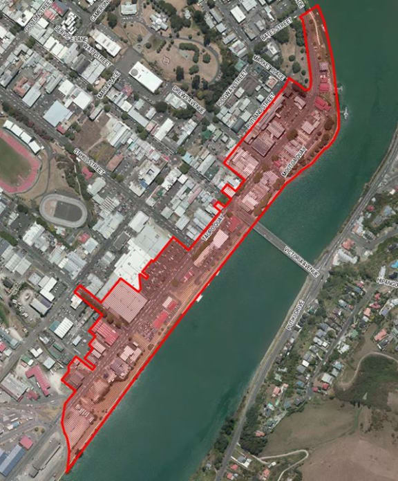
Cordoned off area of Whanganui. Photo: Wanganui District Council
The Wanganui District Council said on Sunday night that 244 people had been through a welfare centre at St Paul's Community Centre since it opened on Saturday morning.
The centre reopens at 8am today. The council said anyone with welfare needs could call 06 349 0001 around the clock.
Twenty homes in Feilding have been evacuated on Queen Street. If people need to leave their properties they are advised to go to the welfare centre on Bowen Street.
A civil defence emergency has been declared in the Whanganui, Taranaki, and Rangitikei districts.
Councils in Horowhenua, Manawatu, Whanganui and Taranaki have activated their emergency management centres, including evacuation facilities.
Police are patrolling the Whanganui East area and cordons are in place Anzac Parade
Schools
At least half a dozen schools are closed today, though some are encouraging students to go along - if possible - with their gumboots to help clean up.
Power cuts
About 650 properties in Wanganui are still without electricity and about 50 are still cut off in Taranaki.
Powerco says some properties are isolated by road washouts, slips and fallen trees and it may be days before the way is clear to get in and restore supply.
Sewage contamination and water issues
Marton residents are being urged to conserve water because of a fault at the town's treatment plant.
Rangitikei District Council says the plant is unable to treat any water at the moment and it is asking people to use water for essential purposes only.
In Hunterville, residents are being asked to boil water because of problems with water quality.
In Palmerston North restrictions on water use introduced to cope with wastewater issues have been lifted. The council said everyone should treat items that have been submerged by flood waters as contaminated.
Whanganui residents have been issued with a similar warning following the reporting of sewage and stormwater spills. People are still being asked to conserve water, as although power has been restored to the Kai Iwi bores which supply the city, reservoirs were now refilling.
The New Plymouth District Council said the sewerage system had been overwhelmed and it has shut down many sewage pumping stations in Waitara, Bell Block and New Plymouth.
As a result, raw sewage is being discharged to the sea from the Eliot St outfall in New Plymouth CBD and from the Waitara outfall, and is also being discharged to the Mangati Stream at Bell Block.
People are being advised to stay away from beaches, rivers and streams.
Road disruptions - State Highways
State Highway 56 at Opiki is closed and a detour is in place.
SH 4 Raetihi To Wanganui and SH43 Stratford To Taumarunui are closed due to slips or flooding.
SH1 is fully open after flooding closed it at the Waikawa River Bridge, between Levin and Otaki, but motorists are advised to take care. It was also closed from Kimberley Road to Hokio Beach Road, in Levin, but had reopened with a 30kmh speed restriction.
SH3 between Whanganui and New Plymouth and between Bulls and Whanganui has also been reopened but caution is still required.
Work is continuing on a number of small slips on SH3 in the Manawatu Gorge, which is likely to remain closed for a few days.
The Pahiatua Track also remains closed but the Saddle Road is open, with efforts to restore access for heavy vehicles.
The Transport Agency said motorists needed to be aware of debris, slips, flooding, one lane restrictions and potholes which were widespread.
Power outages
About 650 Whanganui homes remain without power, and 50 Taranaki homes.
Whanganui road closures as at 5.30am Monday
Urban road closures
Taupo Quay - between Bates Street and St Hill Street
Drews Avenue and Market Place - between Rutland Street and Taupo Quay
Peat Street by substation
Peat Park/London Street
Halswell Street
Alexander Street
Ikitara Road
Quick Avenue
Georgetti Road (open to residents only)
Shakespeare Road
Roberts Avenue
Lucknow Street
Mt View Road
Virginia Road
Rural road closures
State Highway 4 Kaimatira to Raetihi
Kaukatea Valley Road
No 3 Line Wakefield Street to Kaimatira Road
Waikupa Road
Whanganui River Road
Kaurapaoa Road
Kaikokopu Road
Mangamahu Road
Kaimatira Road
Matarawa Valley Road
Okoia Road
Parihauhau Road
Ahu Ahu Valley Road
Rapanui Road
Kaukatea Valley Road
Papaiti Road closed (near 547)
Pipiriki Road
Smith Road
Polson Road
Tokomaru East Road
Tokomaru West Road
Koatanui Road
Rangitatau East Road
Watershed Road
Waipapa Road
Raupiu Road
Junction Road
Bruce Road
Creek Road
Mangawhero Road
Otamoa Road
Siceleys Road
Whanganui walkways closed
City Bridge to Georgetti Road
St John's Hill cycleway
For more information in your area please check the following sites:
Manawatu Whanganui Regional Council
Civil Defence also said people should stay tuned to their radios and monitor the Civil Defence websites for updates.