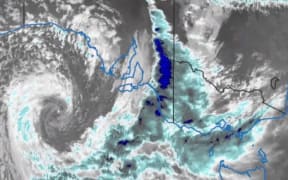
A storm that cut power to the entire state of South Australia this week is expected to hit New Zealand on the weekend - but nowhere near as badly.
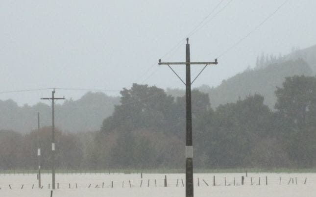
Met Service has warned the rain could exacerbate the already saturated conditions in Waikato, Waitomo, and the Coromandel Peninsula regions (file pic). Photo: Steve MacMillan
All of South Australia was left without power on Wednesday after the storm brought strong winds and some flooding across the state.
MetService meteorologist Claire Flynn said the weather front will hit the West Coast tomorrow night, before moving eastwards over the rest of the country on Sunday, bringing rain to many areas.
Widespread rain with brief heavy falls is forecast for Westland, northern Fiordland, the Nelson ranges and also Bay of Plenty.
She said it will weaken as it moves across the Tasman so the winds will not be as strong as those that Australia experienced.
"It will bring some heavy rain to most places however it will be quite brief but because the front is moving quite quickly rainfall accumulations are looking like they could stay below warning criteria for a lot of places as well," said Claire Flynn.
There is also the potential for squally thunderstorms, especially in the north and west of the country.
The MetService has also issued a severe weather watch for Waikato, Waitomo, and the Coromandel Peninsula regions, where conditions have become saturated over recent days.
It said 20 to 40mm of rain could accumulate during Sunday but with the risk of thunderstorms there is a possibility that will be higher in localised places - possibly 40mm to 60mm.
The MetService said that amount of rain could exacerbate the already saturated conditions in these areas, causing rivers and streams to rise further, with possible surface flooding and slips.
It said there was also a risk of isolated heavy showers through those areas today and again for a time tomorrow, with the possibility of one or two thunderstorms near coastal areas of Waikato and Waitomo this afternoon.
Amounts of 15 to 25mm are possible in localised areas with thunderstorms this afternoon and evening.
The MetService expects a narrow ridge of high pressure should cross the country on Monday, followed by strengthening northwesterlies which will bring heavy rain in southern Westland and Fiordland on Tuesday.
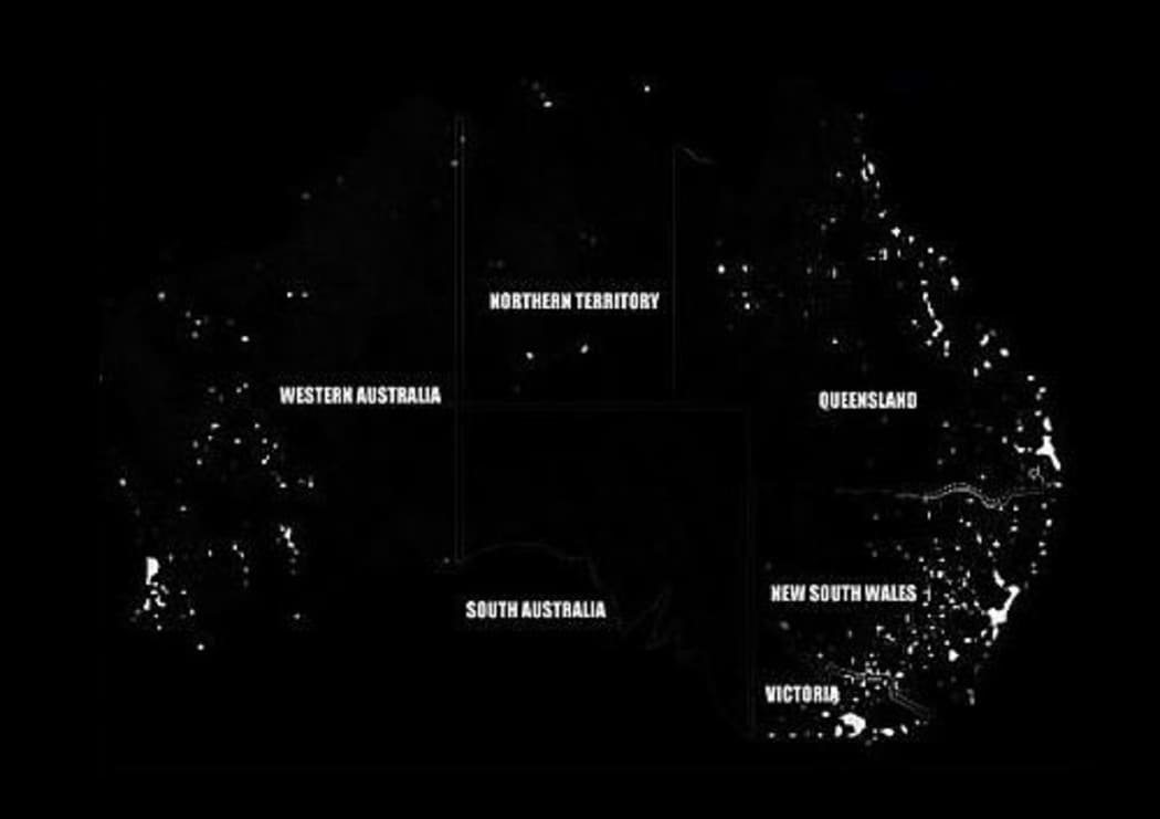
A satellite image shows the blackout that occurred across South Australia Photo: Twitter / Weather WA