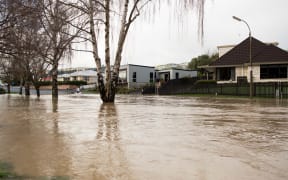
Flooding has affected roads and prompted evacuations in towns and cities across the southeast of the South Island. While the weather has cleared, several states of emergency remain in place.
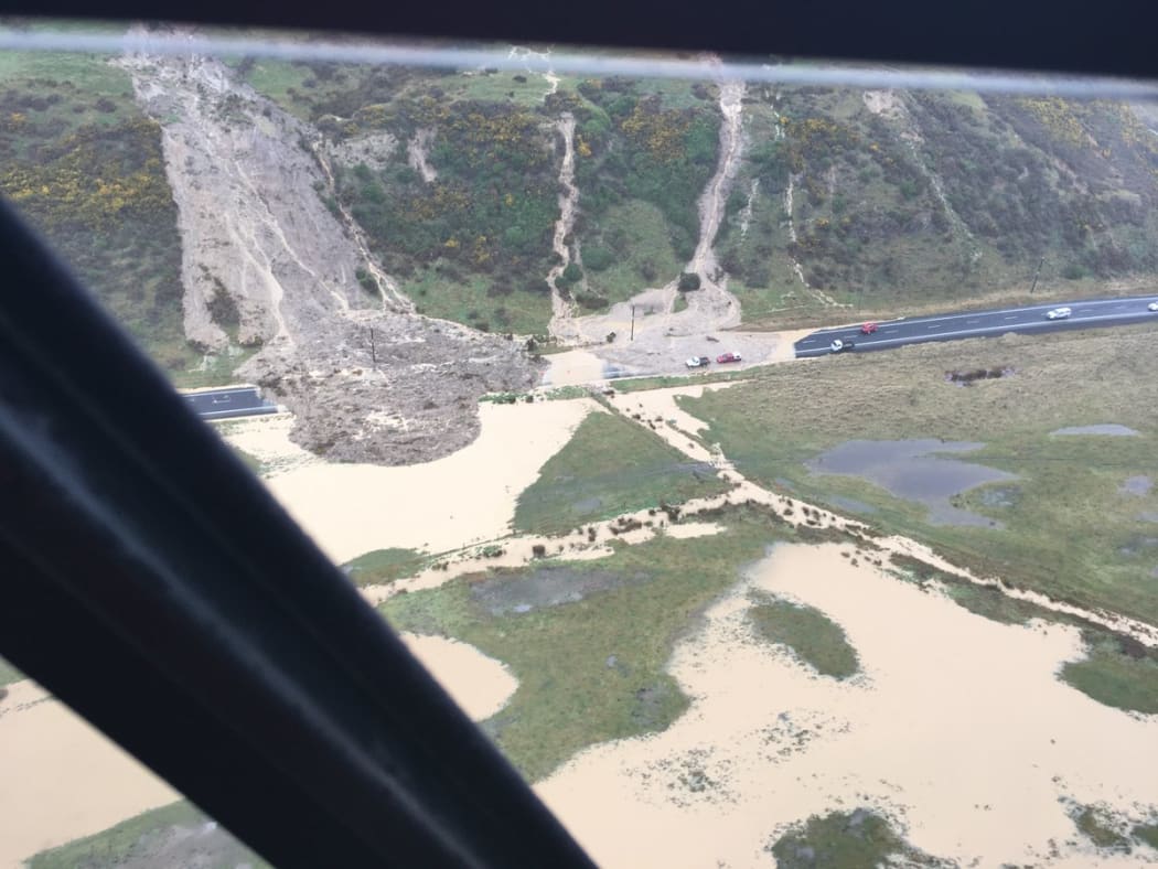
Work to clear a major slip on Otago's Harington Point Road, just past the turnoff to Harwood, will start today. Photo: Twitter / @DnEmergency
Weather
Only one heavy rain warning is in place, for Fiordland. MetService said rain was expected to develop this evening and become heavy overnight, then ease towards midday tomorrow. Downpours were also possible in Westland.
Check the latest weather information here.
States of emergency and evacuations
States of emergency remain in place for the Otago region, including Dunedin and Waitaki, and for Christchurch and Selwyn. The state of emergency in Timaru has been lifted.
The Waitaki and Clutha District Councils closed their emergency operations centres on Sunday afternoon, but the Dunedin Civil Defence Emergency Operations Centre remains open.
Check out this interactive public information map of the emergency areas, with a live feed from NZTA showing road closures, cautions and delays:
Christchurch Civil Defence advised people living in the upper or lower Heathcote areas to evacuate yesterday afternoon. The areas in danger of flooding included Clarendon Terrace, Richardson Terrace, Hunter Terrace, Eastern Terrace, Riverlaw Terrace, Palatine Terrace, Ford Road near Louison Place, Waimea Terrace - but also any other low-lying areas around the Heathcote.
This morning's high tide was lower than expected and no further evacuations of the Southshore or Heathcote River areas were necessary overnight. The next high tide was expected at about 4.15pm, with the Heathcote River expected to peak at about 5.30pm.
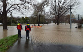
Residents have been warned to wash their hands if they come into contact with floodwaters, which are likely to be contaminated, and to limit water use that produces wastewater - such as flushing toilets or washing - to make sure pumps aren't overloaded.
About 220 households were evacuated across the Otago region, including 100 homes in Outram, inland from Mosgiel.
About 130 properties remain evacuated, mostly in the Henley and Taieri areas. Residents of all but two of the 100 properties evacuated in lower Outram are now able to return home.
Traffic and travel
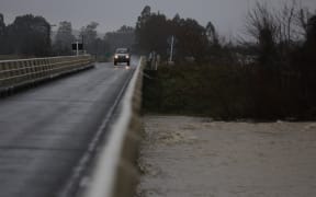
All state highways are now open in the South Island, although many landslip and surface water warnings remain in place.
Work to clear a major slip on Harington Point Road, just past the turnoff to Harwood, has been completed. Residents on the Otago Peninsula north of Harwood remain effectively cut off, with no alternative access route available.
A collision between a truck and a car on Portobello Road near Macandrew Bay in Dunedin this morning temporarily closed that road again, but it is now fully reopen.
Ice on the road is thought to have caused the crash, and drivers are being urged to take extra care with ice affecting several roads in the area.