Residents in parts of South Otago have been told to boil water or conserve supplies after yesterday's heavy rain, as flooding continues to block some South Island roads.
Severe weather warnings in the South Island were lifted last night as rain across the Dunedin and Clutha districts eased off.
The exceptions to this are the Lower Clutha River and the Pomahaka River at Burkes Ford.
In a statement, the Clutha District Council said it was working with the ORC (Otago Regional Council) flood manager on flood flows in the river including water to be released at Roxburgh Dam.
The council issued boil water notices for Glenkenich, North Richardson, Tuapeka East (and also conserve water notices), Tuapeka West, Evans Flat and Waihola.
The boil water notice is in place due to widespread rain and flooding. Any drinking water needs to be boiled for one minute before consumption.
This also includes water to brush your teeth, food preparation and washing food that will not be cooked like salad vegetables and ready-to-eat fruit.
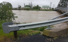
River levels continue to rise adding to yesterday's high levels. Photo: Facebook / Otago Regional Council
Additionally, conserve water notices have been issued for South Bruce, Stirling, Balclutha and Milton.
All residents are advised to conserve water as treatment plants and schemes will be under pressure. This applies to both urban and rural supplies.
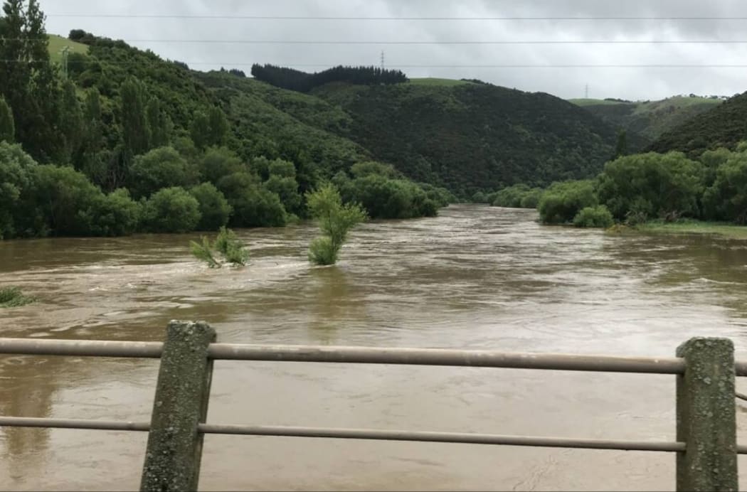
Clutha District Mayor Bryan Cadogan said the Clutha River was at the highest levels seen in 20 years and it is expected to continue rising for the next couple of hours.
He said they were also concerned about the river levels during high tide this afternoon when further rain is expected.
Mr Cadogan said they did not believe the river would will breach, but were keeping a very watchful eye on the situation.
The Otago Regional Council said the Clutha River was being closely monitored over the next couple of hours.
The Clutha River hasn't had flows like this since 1999. We're keeping a close eye on flows & will keep you updated throughout the day. We're also closely monitoring the Taieri River at Outram. Thankfully most other rivers around Otago are now receding. pic.twitter.com/eY8GSz4Mto
— OtagoRegionalCouncil (@OtagoRC) November 20, 2018
A barrier has been installed where the main railway line passes through the Balclutha flood banks to protect the area from flooding.
Meanwhile, Otago residents are waiting for floodwaters to recede so they can begin to assess the damage.
A handful of residents were advised to evacuate their homes last night as the Clutha River rose but most stayed put.
Flooding is also affecting local roads throughout the Dunedin and Clutha districts and the Dunedin City Council has run out of flood signs.
Clutha Valley School will not open and other schools may also be affected by road closures.
The rail line through South Otago and the Taieri Plains is closed due to flooding, and the small settlement of Henley is surrounded by water on all sides.
The Clutha District Council is warning people to avoid all unnecessary travel and stay off the roads if possible.
Those who are out and about are urged to keep an eye out for debris in flood waters and damage to roads.
Drivers are being warned to drive slowly, observe warnings and treat all roads as though they are flooded.
Dunedin City Council urged motorists to stay off the roads until surface flooding around Dunedin and the Taieri Plain recedes.
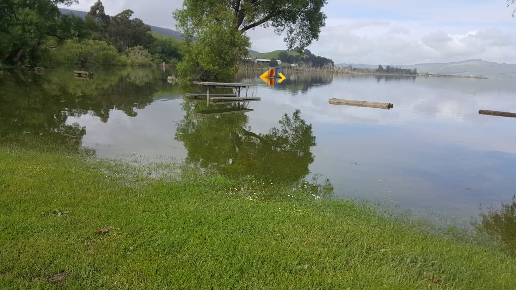
Lake Waihola 15 km north of Milton in Otago has flooded. Photo: RNZ / Tim Brown
State Highway 90 at Pomahaka River Bridge, South of Glenkenich, is closed due to flooding.
Parts of State Highway 8, State Highway 90 and State Highway 1 had been closed because of slips and flooding, but have now opened.
MetService predicted heavy rain and thundery showers for the North Island today.
Some heavy, thundery showers heading to #Auckland in time for the morning commute - check https://t.co/7k3nmdWQwx before heading out ^TA pic.twitter.com/UR6X36l6bV
— MetService (@MetService) November 20, 2018
Tough start to summer for local farmers
Torrential rain and flooding in Otago means a tough start to summer for local farmers.
Taieri River at #Middlemarch about 20 minutes ago. Normally, maybe 10-15 meters wide, and a few metres deep at the lowest point @lertinfo @WeatherWatchNZ pic.twitter.com/bIRLV9DYV9
— Generic Kiwi (@Generickiwi) November 20, 2018
The rain may have eased last night, but farmer James Adam's Henley dairy farm - south of Dunedin - was flooded with a couple of metres of water.
He said if it does not drain, stagnant water may kill the grass on his 190 hectares of land.
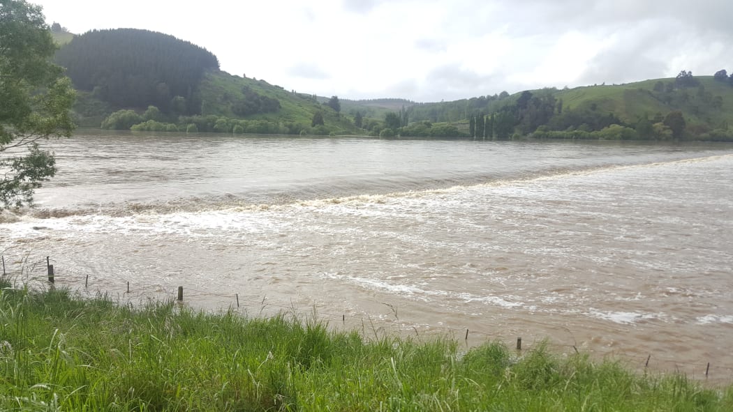
Water continues to pour into flood plains near Dunedin. Photo: RNZ / Tim Brown
It's the first summer flood he's seen in 15 years and it has taken the shine off the start of the season, he said.
Silver Fern Farms has had to suspend operations at its Otago plant.
South Island state highway warnings and closures
Canterbury (Including Alpine / Mountain Pass)
- SH 82 Waimate to Kurow - flood warning.
- SH 82 Waimate to Kurow - due to a washout near Redcliffe Back Rd, there is a speed restriction of 50 km/h in place.
Otago
- CLOSED - SH90 Pomahaka River Bridge, South of Glenkenich - due to flooding, this section of Tapanui-Waikoikoi Highway is closed. Avoid the area or delay your journey if possible. Detour route: Southbound traffic turn left onto Pomahaka Rd, continue along West Otago Rd and onto SH1. Reverse for northbound traffic.
- SH 1 Balclutha to Milton - flooding - the road is now open under stop/go traffic control. Road users are advised to take extra care.
- SH 8 Raes Junction to Milton - the road is now open but a flood warning is in place.
- SH 90 Raes Junction to Tapanui - the road is now open but drivers are advised to consider an alternative route due to multiple slips and floods.
- SH 8 Raes Junction to Alexandra - the road is now open but a flood warning is in place.
- SH 85 Kyeburn to Palmerston - due to multiple slips, caution is advised.
- SH 85 Alexandra to Kyeburn - flooding, caution advised.
- SH 83 Kurow to Peebles - surface water.
- SH 8 Omarama to Tarras (Lindis Pass) - snow.
Southland
- SH 94 Waimea Highway - due to flooding in Otamita, there is a 50km/h temporary speed restriction in place.