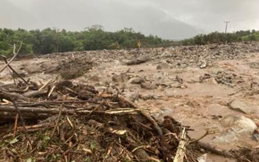
This slip at Harris Creek closed part of SH73 west of Jacksons and and Otira on Thursday 9 March, 2023. Photo: Supplied/ Waka Kotahi
West Coast drivers are being called on to stay off the roads due to heavy rain and flooding, and a slip has shut State Highway 73, a key West Coast to Canterbury route.
The rain was torrential in some areas with roads covered by flooding in some places on the West Coast, Waka Kotahi manager Moira Whinham said.
She called on people to stay put if they could, and if not, to "drive to the conditions'.
Waka Kotahi said mud, rock and vegetation closed State Highway 73 at Harris Creek near Turiwhate, west of Jacksons and Otira, before midday on Thursday.
A local road detour was in place, but it would add an hour or so to the journey to or from the West Coast.
Waka Kotahi said State Highway 73 would remain closed overnight but should be reopened by 10am on Friday.
People taking the detour could travel via Lake Brunner Road and the Stillwater Road turn-off near Jacksons, from the Canterbury side.
Waka Kotahi expected to provide an update Thursday evening.
Lightning strikes over South Island as thunderstorms sweep in, weather warnings posted
Almost 2000 lightning strikes hit the South Island overnight and on Thursday morning as downpours battered parts of the West Coast.
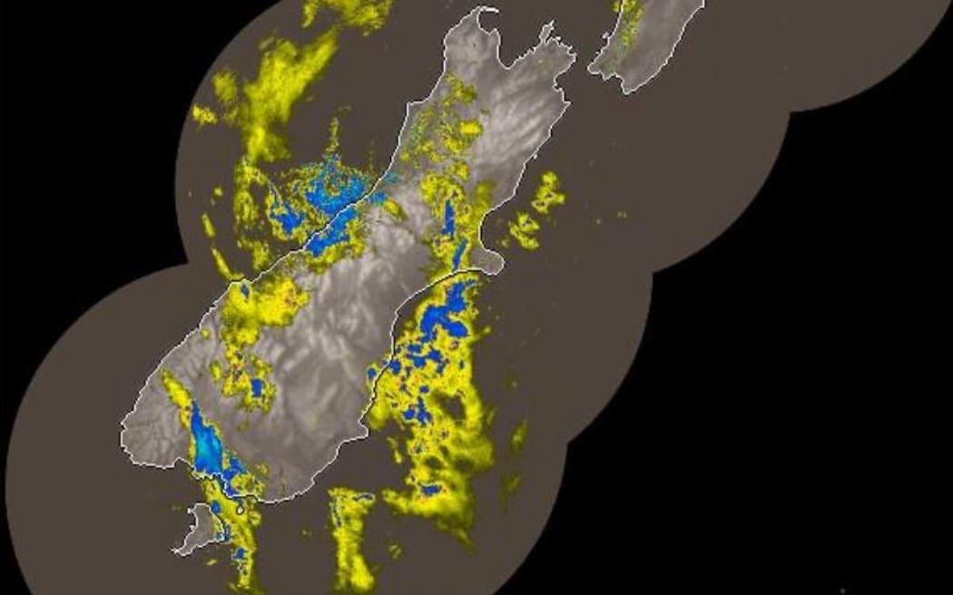
Heavy rain is forecast in the Westland region until Thursday evening. Photo: MetService
MetService recorded 1970 lightning strikes over the South Island between late Wednesday night and Thursday morning.
Orange heavy rain warnings covered Westland and the headwaters of Canterbury lakes and rivers until Thursday evening, though they could hit areas north of Arthur's Pass until 8pm Thursday.
An earlier orange warning had also been posted for heavy rain at the headwaters of Otago lakes and rivers, until 11am Thursday. And the forecaster lifted a severe thunderstorm watch for Westland and part of Fiordland.
The Westland region was forecast to have up to 240mm of rain in the ranges by Thursday evening, with 100mm-140mm expected near the coast and localised downpours of up to 45mm an hour during thunderstorms.
The latest 24h rain accumulations show numbers in excess of 100mm over the mountains of Westland & 50-80mm over coastal stations... and there is still more to come as the active front delivering this heavy rain moves north over the area today
— MetService (@MetService) March 8, 2023
More at https://t.co/qHyE5zzql5 pic.twitter.com/5jzXqZWxzp
West Coast Civil Defence emergency management group controller Te Arohanui Cook told Morning Report surface flooding was likely on the roads, and slips could be brought down later in the day. By early morning there had been no river level warnings, she said.
Thunderstorms were bringing localised bursts of heavy rain rather than continuous downpours in one spot.
"In Hokitika we're going from light rain to short heavy showers but we are aware that they had heavier falls in South Westland from Hari Hari down to Haast."
Thunderstorms were mostly off the coast but had the potential to come back on to land.
With the weather due to clear before the weekend, Cook said, the Wildfoods Festival at Hokitika was still on track.
MetService said thunderstorms in Fiordland on Thursday should ease around dawn, but continue in Westland until late afternoon or evening.