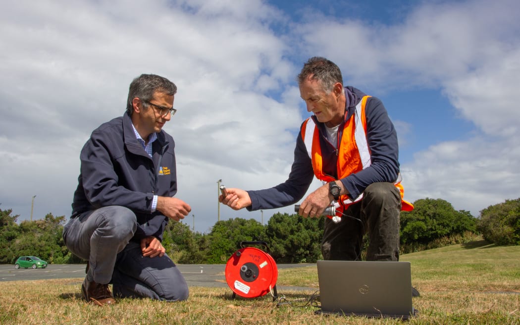
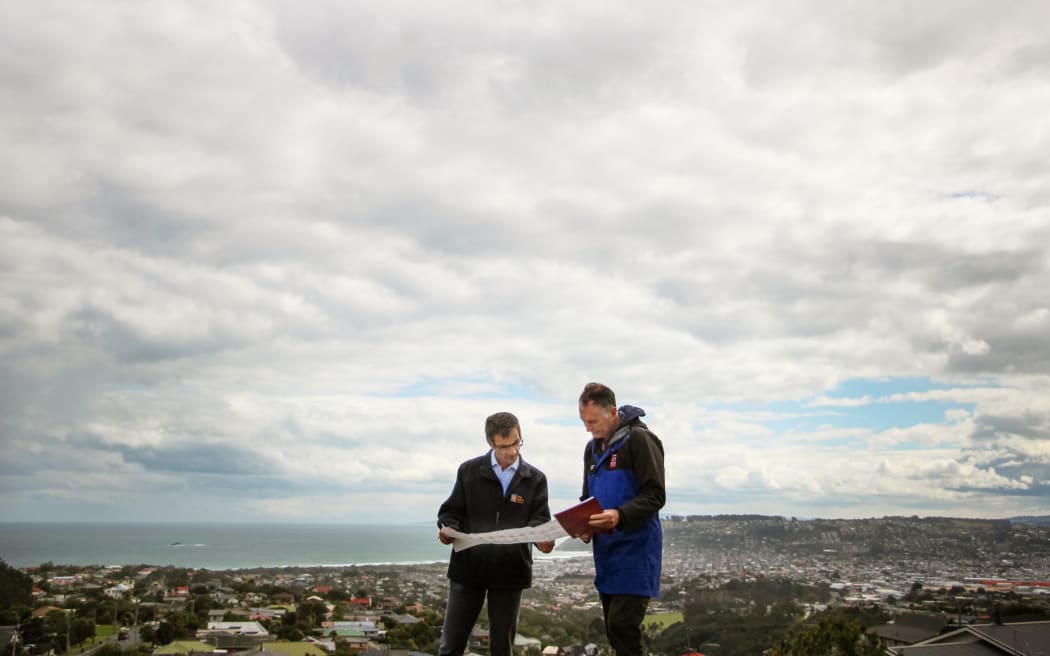
Council natural hazards manager Dr Jean-Luc Payan (left) and GNS Science principal scientist Dr Simon Cox monitor the groundwater behaviour. Photo: Otago Regional Council
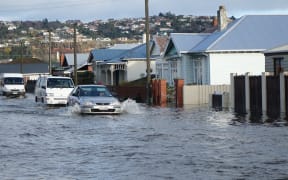
New research shows South Dunedin is not as prone to sea level rise as initially feared but rising groundwater may cause building instability, liquefaction vulnerability and inundate storm and wastewater networks.
GNS Science and Otago Regional Council have been monitoring the behaviour of groundwater beneath South Dunedin and Harbourside near the stadium since 2009.
The South Dunedin region is home to more than 13,000 people and the risk of rising groundwater has been well known but has never been explored in such detail.
The GNS Science report published on Friday used years of data to forecast what the groundwater would do in the future and how it would contribute to different sources of flooding, with plans for it to help communities to prepare and adapt.
The report used forecasts based on 10 centimetre increments of sea level rise instead of timeframe, saying that 40 centimetres of sea level rise might be reached as early as 2077 or delayed until 2126 if CO2 emissions were dramatically reduced.
It showed as sea levels rose, the ground would have less capacity to absorb rain and groundwater would contribute more to flooding, making communities increasingly reliant on their stormwater network.
This was expected to be the dominant issue for the next 30 to 40 years with groundwater rising to the surface periodically while sea level rise remained under 40 centimetres.
Those groundwater issues were expected to emerge well before the sea inundated the land due to the protection from sand dunes - that coastal inundation was unlikely to occur until sea levels rose by 60-70 centimetres.
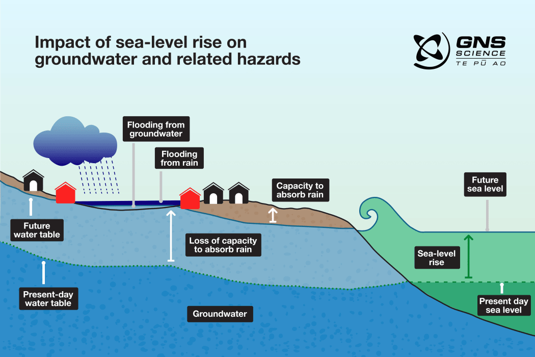
Photo: GNS Science
GNS Science principal scientist Dr Simon Cox said rising groundwater could create problems including possible health issues caused by rising damp.
"It might be a problem to the saturation of deep foundations in buildings to start with or it might enter into basements as people have found overseas in groundwater flood events," Cox said.
"It can change the vulnerability to liquefaction during an earthquake. As it gets shallower, the vulnerability goes up and the possibility of liquefaction gets greater."
The research showed South Dunedin needed to plan for water coming from above, below and sideways, but that most of the area sat on relatively old, thick mud which groundwater moved slowly through.
"We discovered the ground is not as permeable as we thought it was and we're not as prone to the effects of sea level rise as we initially feared when we first started working in South Dunedin way back in 2009."
That was due to earlier research focusing on a key bore hole on Kennedy Street that varied 30-40 centimetres with the tides.
"When those initial models were done, if you assume that all of the places close to the coast were going to vary by 30 centimetres, then it would mean that everywhere would get the high tide coming through the ground very soon and it wouldn't take much sea level rise for the high tide to always be flooding," Cox said.
He said the new forecasts might give the city a little more time to prepare and respond, particularly through the South Dunedin Future programme.
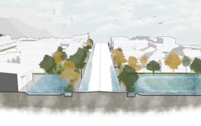
Last December, South Dunedin Future released a list of 16 potential approaches to help communities to adapt, ranging from managed retreat, banning development in higher risk areas, improving water storage to ground strengthening.
Its programme manager Jonathan Rowe said the report was well-timed as they had just started their detailed risk assessment.
"Better quality information helps us to have better conversations with the communities, more informed conversations. It also enables us to make better decisions, design better solutions and make more informed judgements around what the respective merits [are] around different approaches, what's the cost benefit over different time frames," Rowe said.
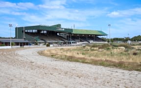
On Thursday, the Dunedin City Council announced it had bought a nearly 12 hectare former racecourse, Forbury Park for $13.2 million, with plans to consult the community about potential future uses.
Dr Jean-Luc Payan and Dr Simon Cox monitor the groundwater behaviour in South Dunedin which is seen in the background. Photo: Otago Regional Council
The GNS Science report showed Forbury Park in South Dunedin was low lying with high groundwater, and that was expected to rise further alongside sea levels.
Rowe said the purchase would give them lots of flexibility to manage groundwater and possible solutions that would benefit the wider area.
"It just basically is this big piece of the puzzle that we now have some control over and will help us with an overall solution."
Otago Regional Council natural hazards manager Dr Jean-Luc Payan said the report built on the monitoring the council and GNS Science had done since 2009, with their site numbers growing from four to 35 in 2021.
"It provides a detailed picture of where and when issues will arise, mapped out against 10 centimetre increases in sea-level rise," Payan said.
"This helps us to understand how hazards will evolve and enable planning for the future. It's an important tool in determining adaptation options for the future of South Dunedin."
Dr Simon Cox described groundwater variations as "almost like it's breathing", depending on the rainfall and the runoff.
The research has taken detailed levels over four years, analysing all of the fluctuations caused by tides, rain and other factors.
He hoped residents would now feel confident that they were getting the best possible information about their community.
"We can measure for every millimetre of rain how many millimetres does the groundwater go up and in some cases it goes up ten times more."
It was critical to know the storage ability of the ground so they could map out the flood hazard, he said.
The report received about $500,000 in government funding along with $50,000 in co-funding from the council.