

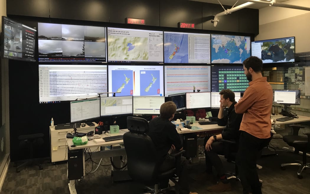
Monitoring data in the NGMC. Photo: Claire Concannon / RNZ
It could be the headquarters for a rocket launch, or the control centre for a highly coordinated operation. One wall is full of large monitors, information updating in real time. Cameras, maps of the Pacific, incoming streams of data. A room that never sleeps, that’s always on alert.
Follow Our Changing World on Apple Podcasts, Spotify, Stitcher, iHeartRADIO, Google Podcasts, RadioPublic or wherever you listen to your podcasts
24/7 operation
This is the National Geohazard Monitoring Centre (NGMC). Based at GNS Science in Lower Hutt in Wellington, it’s part of GeoNet – the programme tasked with New Zealand’s geohazard monitoring and response, operated in partnership with Toka Tū Ake EQC, Toitū Te Whenua Land Information New Zealand and GNS Science
Kimberly Presow has worked here for five years, since this new 24/7 version of the centre opened in 2018. She’s a shift leader now, responsible for one of the teams of geohazard analysts that constantly scan the monitors for any changes that might indicate a significant geohazard event.
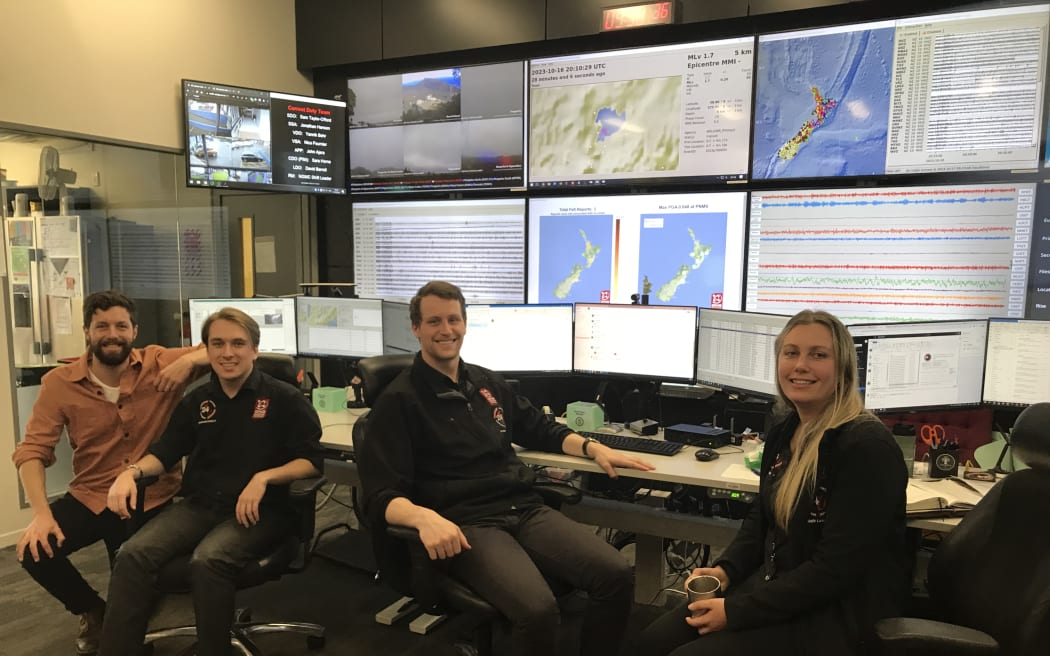
The NGMC: Dr Jonathan Hanson, Lachlan Hill, Ryan Brock, and Kimberly Presow. Photo: Claire Concannon / RNZ
Four main geohazards
While keeping an eye out for earthquakes is the bread and butter of the NGMC, they are also on alert for three other geohazards: landslides, tsunamis and volcanic activity. A network of seismometers, underwater pressure sensors, coastal gauges, cameras and international monitoring stations constantly feed data into this room, where the geohazard analysts are wary to any changes in the patterns.
A pager will sound for anything greater than a magnitude six earthquake, but the geohazard analysts will be on alert for any change they see in the incoming data. And once something is identified, they will work quickly to assess and update the information, sometimes correcting errors in the automatic system – which may, for example, see one earthquake when there were two.
Coordinating the response
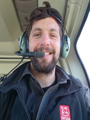
Dr Jonathan Hanson Photo: Jonathan Hanson
When a large event occurs the NGMC goes into response mode.
The analysts alert civil defence, and the on-call duty scientist will be looped in to give their assessment. From there, depending on the scale of the hazard, an entire panel of expert scientists might be assembled. In the meantime, the incoming data is being constantly assessed and updated, to fine-tune the information about the location, scale and repercussions of the event, to further inform civil defence.
Dr Jonathan Hanson works with Geonet as the chief data scientist and as a duty seismologist. He describes what unfolded on 5 March 2021, when three large earthquakes occurred in New Zealand territory, with the potential for damaging tsunamis to hit the north and east coasts of the North Island.
Listen to the episode to learn more about how the NGMC works, and how Kimberly and Jonathan approach their roles in the response to major geohazard events.
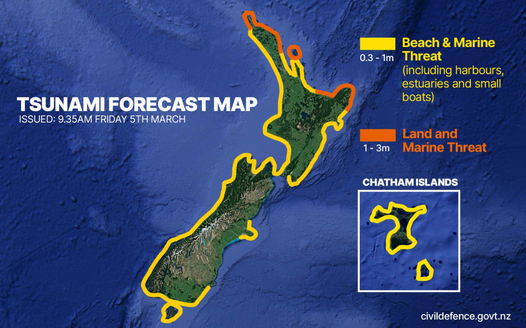
The tsunami forecast following three major earthquakes on 5 March 2021. Graphic: RNZ / Vinay Ranchhod / Civil Defence
To learn more:
-
Our Changing World has an earthquake episode collection where you can learn a lot more about the geohazards that affect Aotearoa.
-
We know that the Alpine Fault is due for a large earthquake, so many researchers are trying new techniques to accurately model what will happen when it goes so we can best prepare.
-
There are also other fault lines, including low-occurrence ones that rupture on longer timescales, such as the Nevis Valley fault. To investigate its past, researchers need to do paleoseismic trenching.

