Heavy rain warnings have been upgraded to red for the Wairoa District and Gisborne, with downpours and gales forecast to lash the eastern North Island as Cyclone Fili closes in.
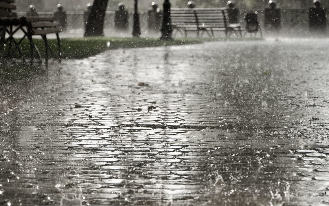
Photo: 123RF
MetService has issued severe weather warnings for the Bay of Plenty and Gisborne regions with Cyclone Fili expected to track southeastwards across the east of the North Island on Wednesday, then move away from the country on Thursday.
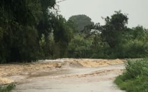
Wairoa District and the Gisborne region were expected to get 200-300mm of rain expected over 24 hours starting around 10pm tonight.
Rainfall could reach peak rates of 15-25mm per hour while levels of 35-50mm per hour are possible in some areas tomorrow afternoon.
Here comes the rain! A few showers already making landfall, and the leading rain band is visible on the radar now. Keep an eye on it at: https://t.co/F9fZPWyoen pic.twitter.com/2up8Q3d5mb
— MetService (@MetService) April 11, 2022
Heavy rain is expected to cause dangerous river conditions while significant flooding and slips may lead to road closures and the potential isolation of some communities.
A strong wind warning is also in place for both the Wairoa District and the Gisborne region from Wednesday afternoon with south to southwesterlies gusting up to 120km/h in exposed places.
MetService warn strong winds could damage trees, powerlines and unsecured structures.
MetService meteorologist Lewis Ferris told Midday Report winds are expected to be stronger then in the storm three weeks ago.
"So it's not just going to be the heavy rain impacts that are going to cause issues ... the roading network is already fragile, the people have had to deal with this just three weeks ago so it's coming at awful timing," Ferris said.
He said the incoming weather had the potential to undo clean-up efforts in the region which have been underway since the storm hit three weeks ago.
Bit of good news/bad news from our latest high-res modelling.
— NIWA Weather (@NiwaWeather) April 11, 2022
Good news: most of Auckland (less Great Barrier)/Northland, gusts should be less than 100 km/h.
Bad news: Hawke's Bay/Gisborne, gusts well over 100 km/h are expected tomorrow, likely causing damage & power cuts. pic.twitter.com/0jCMHhMXGT
Wairoa considers state of emergency
Wairoa mayor Craig Little said authorities were considering calling a state of emergency in advance of the storm expected to hit the region.
There's a red rain warning in place for the district in Northern Hawke's Bay, as well as Tairāwhiti.
Up to 350 millimetres of rain is expected in the Wairoa district in just over 24 hours.
Little told Midday Report the state of emergency could be called as early as this afternoon.
Meanwhile, authorities in Hawke's Bay are checking flood protection infrastructure to ensure it's ready for the upcoming deluge of rain tonight.
Hawke's Bay's civil defence controller Ian Macdonald says a emergency co-ordination centre in Hastings has been set up, in preparation for the storm.
He said if people living in the Wairoa district live close to waterways or steep slopes, they should be ready to evacuate.
He urged farmers to move stock and equipment to high ground as the storm may impact rural areas the worst.
Travel alert
Transport Agency Waka Kotahi is asking people in Tairāwhiti and Hawke's Bay to avoid travel from late Tuesday until early Thursday.
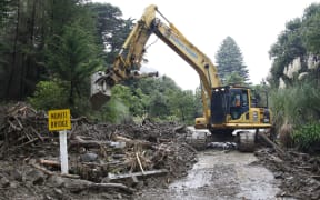
The ground in the regions is still saturated from the big weather event just three weeks ago and Waka Kotahi says it might have to close highways.
It is urging people who were worst impacted last time, particularly around Wairoa, Tokomaru Bay and Te Puia Springs to prepare for the possibility of further road closures and to get everything they need now.
If people must travel, Waka Kotahi says people should slow down and increase following distance between vehicles.
Gisborne camping grounds to shut
Gisborne District Council says it's closing all of its camping areas, with the expected arrival of heavy rain tonight.
Those using council camping spots will be asked to go to a commercial campground where they can be better supported through this storm.
The council says there is still a lot of damage from the flooding three weeks ago.
East Coast residents have been asked to prepare in case they need to evacuate.