Preferred options to protect Westport with a new flood protection scheme to ring-fence the township will cost at least $26 million.
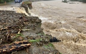
File photo: Snodglass Road in Westport was flooded in many areas in 2021, inundating homes as a result of former cyclone Fehi. Photo: RNZ / Rebekah Parsons-King
A report to the Westport Rating District Joint Committee tomorrow afternoon includes two recommended options costing $18.9m and $16.9m from a technical advisory group to go to the West Coast Regional Council and Buller District Council as they finalise their proposal to the government.

The business case for Westport - regarded as a 'test case' for government co-investment - is due to go to Cabinet this month.
Both options include an extensive floodbank skirting Carters Beach and the Westport Airport on the south side of the Buller River.
However, the flood-prone Snodgrass Road area just north of Westport on the Orowaiti Estuary is excluded altogether, and dredging the lower Buller River and creating a direct cut to the sea from the Orowaiti Estuary have been ruled out.
The advisory group report said both councils must now decide the preferred option as it was seen as "more political than technical".
It said consideration might be given to:
- Option two at a little over $2m cheaper
- Number of houses and the protected area; option one being larger than option two
- Risk of further urban intensification enabled by option one.
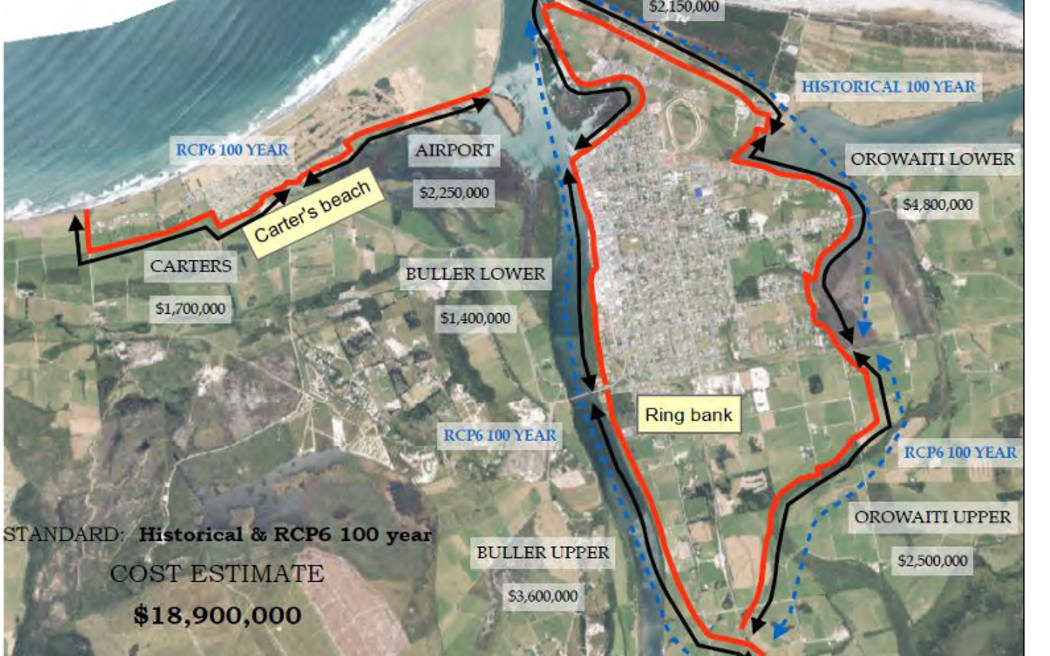
Proposed option one for a Westport flood protection scheme to encircle the town. Photo: Supplied / West Coast Regional Council
Option one extends the ring embankment area further inland from the current area of urban development than option two.
The report notes the flood risk due to Westport's geographic location, on an island wedged between the Buller and Orowaiti rivers. The Buller River has the largest flood flow of all rivers in New Zealand.
The report notes the regional council has investigated flood mitigation scheme proposals for Westport since the mid-2010s.
It adopted an extensive stopbank and floodwall scheme estimated to cost $10.2m in the 2021-31 long-term plan, as supported by 71 percent of Westport rating district submitters to the draft plan.
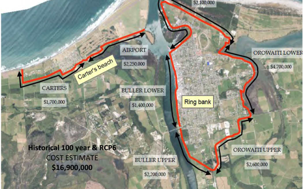
Proposed option two for a Westport flood protection scheme to encircle the town. Photo: Supplied / West Coast Regional Council
The councils requested co-investment from the government following the severe flooding last July.
Local Government Minister Nanaia Mahuta has required that climate change and wider community 'resilience' be addressed within proposed flood mitigation measures.
Among eight recommendations for today's meeting is the business case for an estimated $26m cost to be split 75:25 between the government and councils.
Local Democracy Reporting is Public Interest Journalism funded by NZ on Air