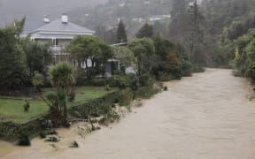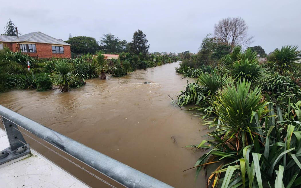
Auckland's Oakley Creek flooded in May. Photo: RNZ / Finn Blackwell
Almost a dozen towns and cities across the country have already experienced their annual rainfall in just six months, according to NIWA.
All locations were in regions heavily hit by Cyclone Gabrielle and the Auckland Anniversary floods, including parts of Northland, Auckland, Bay of Plenty, and Eastern North Island.
NIWA said Kaikohe had fared the worst, receiving more than 130 percent of its annual rainfall between January and June.
Also making the list were Whangārei, Warkworth, Leigh, Whangaparāoa, Albany, Māngere, Tauranga, Gisborne, Tūtira and Napier.
In comparison, Waimate in South Canterbury received just 30 percent of its normal annual rainfall in the same period.
Temperatures over that same period were 1.1˚C above average, according to NIWA's seven station temperature series which began in 1909.
This is the second warmest such period on record. Only 2016 had a warmer January-June.
The 11 locations that recorded over a year's worth of rain in the first six months of 2023:
- Kaikohe (2140mm)
- Whangārei (1526mm)
- Warkworth (1525mm)
- Leigh (1234mm)
- Whangaparāoa (1114mm)
- Albany/North Shore (1319mm)
- Māngere (1152mm)
- Tauranga (1335mm)
- Gisborne (1230mm)
- Tūtira (1359mm)
- Napier (984mm)
Parts of the northern & eastern North Island have already received a year's worth of rain just 6 months into 2023
— NIWA Weather (@NiwaWeather) July 6, 2023
We crunched the numbers & 21 locations in 7 different regions experienced a record wet January-June!
The why behind the wet (& warm) https://t.co/IpEuTdxOzq pic.twitter.com/PCzFhSoIph
What's behind the rainfall?
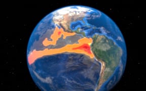
MetService forecaster Lisa Murray said climate change, a marine heatwave and La Niña were all partly to blame.
Although La Niña officially ended earlier in the year, the lingering influence contributed to an air pressure pattern that brought more sub-tropical, north-easterly winds, atmospheric rivers, and increased the risk for ex-tropical cyclones.
Persistent "blocking" high pressure near the South Island enabled rain-bearing weather systems to linger for long periods of time, sometimes affecting the same regions day after day.
Frequent air flows from the north-east, reduced westerly winds, high pressure near the South Island, and climate change enabled this to bring warmer temperatures and increased moisture availability to the New Zealand region.
The impact of climate change left a strong imprint on the record warmth and exacerbated the extreme rainfall events during the first half of the year, NIWA said.
"All these things have combined along with a bit of being unlucky as well, because they could have gone a little way east, they could have gone westwards, but actually they came down over New Zealand," Murray said.
"So we have the situation where we've had event after event after event. Some of those regions are very saturated even still."
What's to come?
MetService has forecast more rain for the east from Sunday.
El Niño is emerging in the tropical Pacific and is expected to bring different weather patterns during the next six months.
"The systems we have coming through at the moment, and continuing really for much of July, are very fast moving systems. So although they will come in and bring some heavy rain, they will move through quickly," Murray said.
During late winter, spring, and summer, southwesterly-to-westerly winds will become more prominent.
Historically, this had increased the chance for drier-than-normal conditions in eastern areas of the country and caused more rain in the west, NIWA said.
"In summary, a change in the climate driver means a change in the wind, and ultimately, a likely change in rainfall patterns. The weather is likely to be quite different to what we've been living through in recent times," NIWA meteorologist Ben Noll said.