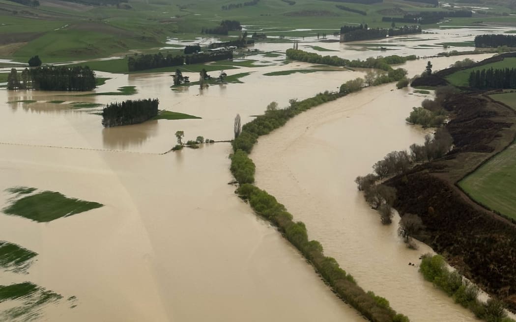
Mataura River during Southland flooding on 21-22 September 2023. Photo: Guy Dowding/High Country Helicopters
Much of the country faces severe weather warnings as the weekend - and the school holiday - begins.
Heavy rain and snow warnings are in place as the south of Te Wai Pounamu cleans up after widespread flooding and damage in Southland and Otago.
What's forecast to come:
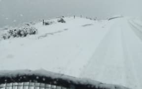
While heavy snows continues to blanket inland South Island, MetService says wet is the theme of the weekend for Te Ika Māui - where everywhere is expected to get rain.
On Friday evening, MetService said: "A slow-moving front over the South Island should move onto the North Island tonight and continue moving slowly eastwards across the Island during the weekend. Warnings and Watches for heavy rain are in force for many parts of New Zealand, and for heavy snow in Canterbury and Otago."
Heavy rain warnings were in place for Tasman west of Motueka, The Bryant and northern Richmond Ranges, Westland south of Otira, and the headwaters of the Canterbury lakes and rivers south of Arthur's Pass.
In some places, rain of up to 120mm was expected to accumulate by midnight Friday or 4am Saturday, turning to snow in some higher areas.
Heavy snow warnings were in place for Mackenzie Country and inland Canterbury, Central Otago and Queenstown Lakes north of a line from Wanaka to Ranfurly, until late Friday night.
But the mayor of Queenstown is imploring holidaymakers not to stay away, despite the town being under a state of emergency. Glyn Lewers said the town should be operating at 95 percent in a few days.
Large parts of Queenstown also remain under a boil water notice due to a Cryptosporidiosis outbreak linked to the town's main water supply.
Snow up to 10cm deep was expected to fall to 200m in the Canterbury foothills and snow up to 30cm deep was expected in some inland Canterbury areas.
Other parts of Central Otago and Queenstown Lakes are under a heavy snow watch.
Road snowfall warnings are in place on Friday for Arthur's Pass (SH73) and Porters Pass (SH73).
As the weekend progresses, heavy rain watches are in place for Northland, Waitomo, Taumarunui, Taihape, Whanganui, and Taupo west and south of the lake, Taranaki, the Tararua, Wellington, Kapiti Coast, and Wairarapa about and south of Featherston Range. In the South Island, they are in place for Buller and Westland, the Canterbury Plains, including Christchurch and Banks Peninsula, and Otago excluding Clutha.
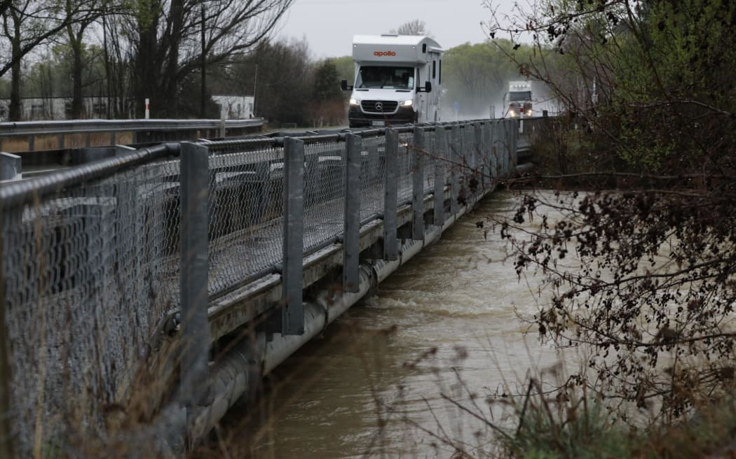
Twizel River in Canterbury following severe weather in the South Island which saw Southland and Queenstown declare states of emergency. Photo: RNZ / Nathan McKinnon
Further out
"A front moves slowly eastwards across the North Island on Sunday and Monday, and a low may develop on it, deepening over or near the North Island on Monday," MetService said in its severe weather outlook.
"There is moderate confidence of warning amounts of rainfall across the upper North Island from Sunday to Monday, from Taranaki, Whanganui, Taihape, inland Hawke's Bay and Gisborne northwards, including northern Gisborne about East Cape. Heavy rain watches are in force for some of these areas, and more are likely to be issued.
"North to north-east winds are likely to strengthen from Sunday to Monday as the low deepens."
It was possible severe gales could hit the upper North Island as well. From Sunday to Monday, heavy rain could affect parts of the lower North Island.
MetService said heavy rain watches that had been issues would likely be upgraded and added to in coming days.
What's happened so far
On Friday afternoon, Meteorologist Clare O'Connor says the rain is easing in Southland, but is now hitting the West Coast.
Meanwhile, snow had begun to fall in the lower half of the South Island.
Southland
Tuatapere residents were beginning a clean-up, and the Invercargill City Council said heavy rain had ceased, but several roads in the region are closed due to flooding, rising rivers and debris.
A small number of homes in Wallacetown, Southland, were evacuated on Friday afternoon as the Ōreti River reached its peak.
Shortly after 4pm, the Ōreti River was running 4m above normal at Wallacetown and falling at 29mm per hour.
Emergency Management Southland said the Wallacetown Community Centre was open to anyone who needed assistance. Community emergency hubs that were open in Gore and Mataura have closed.
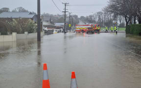
A state of emergency remains in place for Southland, with widespread flooding and many roads closed, people are reminded not to enter floodwaters.
River levels remain high in Southland and while most have peaked, others including the Mataura will not reach their peak until this evening.
Environment Southland says 14 sites are at flood warning status and 19 are at a high river watch status.
The Mataura River level is falling and the flood peak has passed through Fairlight, Parawa and Cattle Flat. Flooding is expected in the lower catchment area, from around 9 pm in Gore this evening, through to 6am at Seaward Downs.
Further flooding is also expected in the lower reaches of the Ōreti River, with the peak expected at Wallacetown about 4pm.
The Makarewa River is expected to peak mid-afternoon at Counsell Road.
The Clutha River is running higher than usual after heavy rain belted the lower South Island. The Clutha District Council said the Roxburgh Dam released more water last night so the river was running higher than usual.
South Otago's Pomahaka River is sitting just below the second flood alert for the Burkes Ford area.
Several closed landfill sites in Southland remain under water. Southland District Council staff are monitoring the closed landfill sites at Bayswater east, Fairfax and Bayswater west.
Manhole covers were blown open in most towns and council staff are working to get these closed, assess overflows and begin cleanup where possible.
Gore Mayor Ben Bell said the district's emergency response had been stood down as rainfall eased.
In an update to residents on Facebook, Bell said the Mataura River was expected to peak later this evening.
But he said the flood banks were high enough to handle the deluge and Gore was likely to make it through okay.
Several roads remain closed, including State Highway 1 between Gore and Mataura. People are being urged to avoid travelling through Southland and Central Otago because of flooded roads and snow.
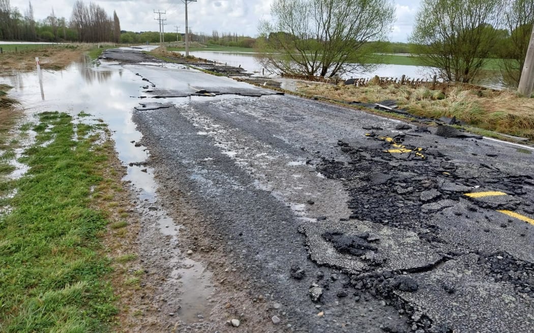
Fairfax Isla Bank Road in Otautau on 22 September 2023, a day after heavy rainfall and floods hit Southland. Photo: Supplied / Southland District Council
State Highway 8 through the Lindis Pass is closed to towing vehicles, while State Highway 80 has closed to Mt Cook.
State Highway 6 is closed near Makarora, south of Haast Pass.
Queenstown
NIWA said Queenstown recorded 87 millimetres of rain in the past 24 hours - its wettest day in 24 years. More than 100 residents had been evacuated.
The Queenstown Lakes District Council (QLDC) said an initial clean up operation was underway at Isle Street, Robins Road, Duke Street, Shotover Street and Camp Street.
QLDC was yet to find a safe way to clear debris brought up by flooding and slips.
Debris from flooding and slips on Memorial Street in Queenstown as seen on 22 September 2023. Photo: Supplied / Queenstown Lakes District Council
Geotechnical engineers were working with the Council to clear Upper Brecon Street, where several businesses were affected. Parts of the Queenstown Cemetery are damaged after a slip and it is closed to the public while assessments are made.
Emergency Operations Centre Controller Ken Bailey said teams were liaising with religious groups and iwi. He said the clean-up relied on dry weather conditions, but good progress had been made.
Central Otago
Residents in part of Central Otago are being asked to conserve water as heavy rain lashes the area.
The Central Otago District Council is issuing notices for the towns of Naseby and Omakau as a precaution.
The Naseby water treatment plant is currently inhibited but has sufficient storage for several days.
Meanwhile, the Omakau water treatment plant is still producing water but council says this could change as the nearby Manuherekia river level continues to rise.
The council says it wants to give residents adequate notice of potential impact to our water supplies.