
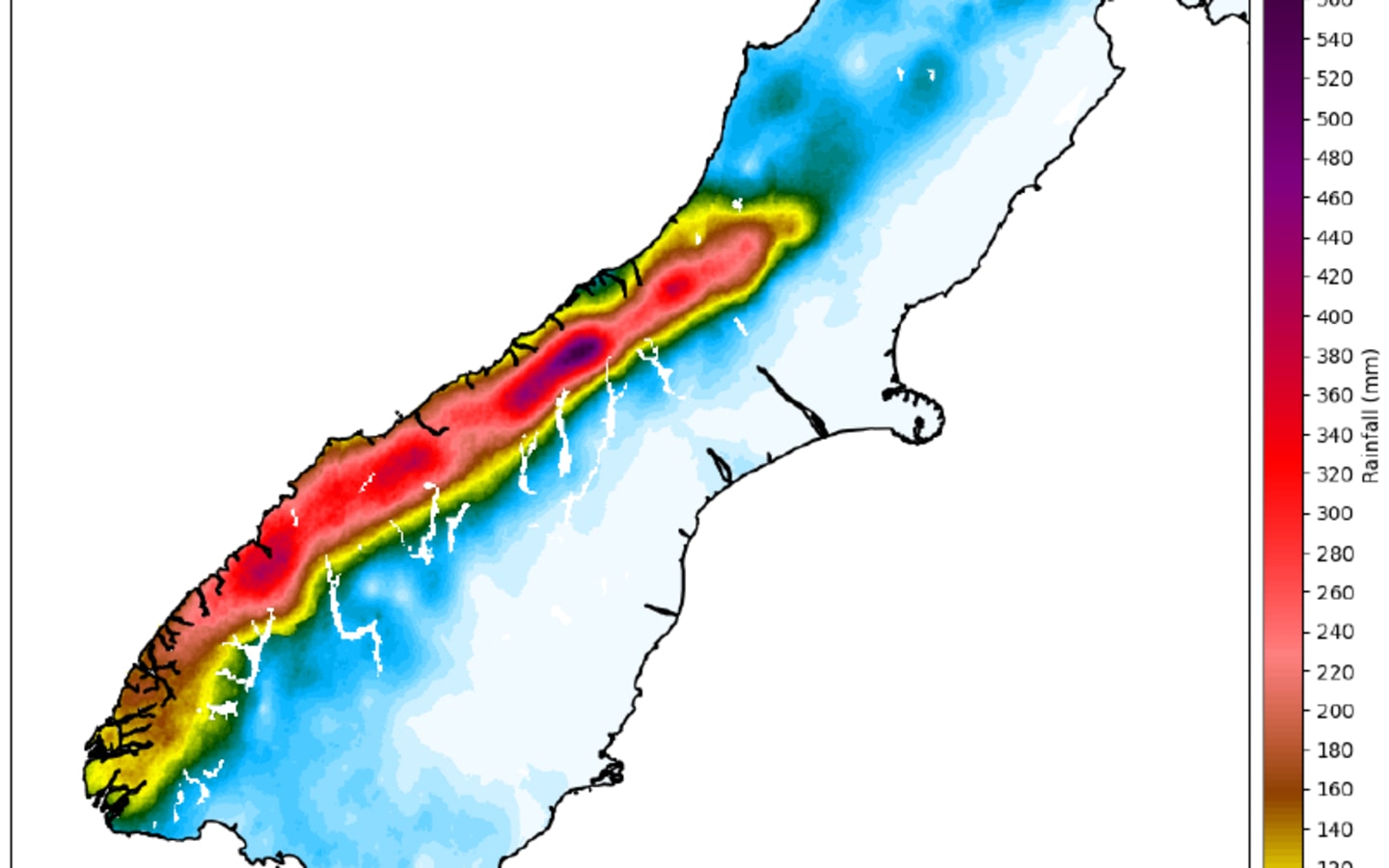
A MetService graphic showing the radar rainfall accumulation for the hours the Red Warning was issued for South Westland. This shows where the radar detected rainfall across the region during the warning period. Photo: MetService/ via LDR
The West Coast Regional Council is reviewing its use of MetService weather forecasts in its hydrology and emergency planning after what has been dubbed two "over-estimated" rain warnings for the region.
South Westland was put on high alert following a MetService 'red alert' on 18-20 January, with up to 800mm rainfall forecast in the Waiho (Waiau) River catchment at Franz Josef Glacier.
On 26 January it issued another warning of up to 250mm rain. Local authorities mobilised, but the alert scenarios did not approach those maximum volumes.
West Coast Regional Council chairman Peter Haddock said this week that the official forecasts "not matching" reality was a real problem for the region.
The last two forecast events, with the consequent warnings, had been "totally wrong" and only succeeded in "scaring the public away", Haddock said.
He called for the regional council and West Coast Civil Defence to use a range of forecasters, "as opposed to MetService".
Westland District Council declared a state of emergency on 19 January based on the red alert warning of up to 800mm falling in 47 hours. It cleared and shut State Highway 6 all the way from Ross to Haast.
The rest of the region north of Hokitika was also subject to an orange alert that weekend, but instead enjoyed balmy weather - after visitors and several events had already cancelled plans.
The 26 January rain warning also came to nothing, but not without sensational headlines, including on RNZ, which said the "already sodden" West Coast was to have another deluge.
Haddock said offers of help poured in from South Island local authorities, and he responded by sending back photos showing the West Coast enjoying sunshine.
A better weather forecast approach to inform the appropriate response from the councils and Civil Defence was needed, he said.
"I believe other government agencies don't (only) use MetService," Haddock told the council meeting on Monday.
Chief executive Darryl Lew said the MetService forecasts for the last two events had "overestimated the rain" in South Westland.
"It is due to that, that a lot of regional councils don't just rely on MetService," Lew said.
He was considering adding Niwa as it had "significantly increased its level of forecasting", noting that DOC now used Niwa in a range of forecasts. That agency also had the benefit of providing corresponding flood modelling.
"I'm leading an internal debrief inside regional council hydrology and Civil Defence. That will endorse Niwa plus MetService," he said.
Lew, who had a background as a hydrologist, said peak forecasting was "vital" to understand the potential for flooding.
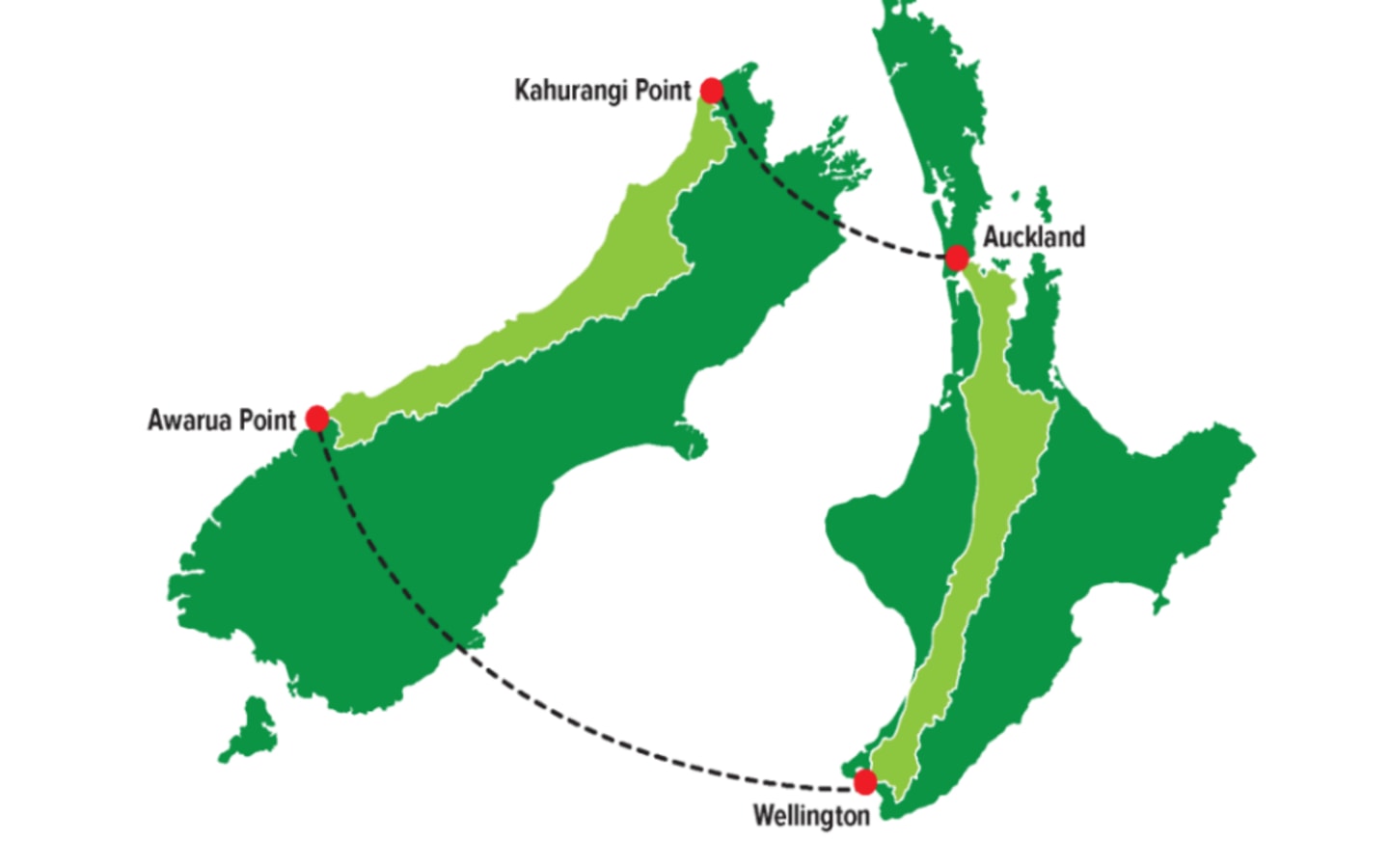
A geographic comparison of the 650km long West Coast Region, often used by the regional council in official submissions to highlight the challenges in servicing the sparsely populated region (about 32,000). Photo: Supplied/ West Coast Regional Council
Councillor Andy Campbell of Hari Hari said the 650km-long West Coast had varying weather patterns anyway, in contrast to that represented in forecasts and relayed in the national media.
"A lot of it is localised."
Speaking after the meeting, Haddock said he used a range of weather forecasters himself and discounted predictions by a large percentage of them, finding this was usually more accurate than official forecasts.
What had transpired "was basically a non event" on 18-19 January, and again the following weekend.
The coast deserved better given it is the same distance from Auckland to Wellington - and with businesses and visitors reliant on reputable forecasts.
"It's the reputational damage with people thinking this is an unreliable place," Haddock said.
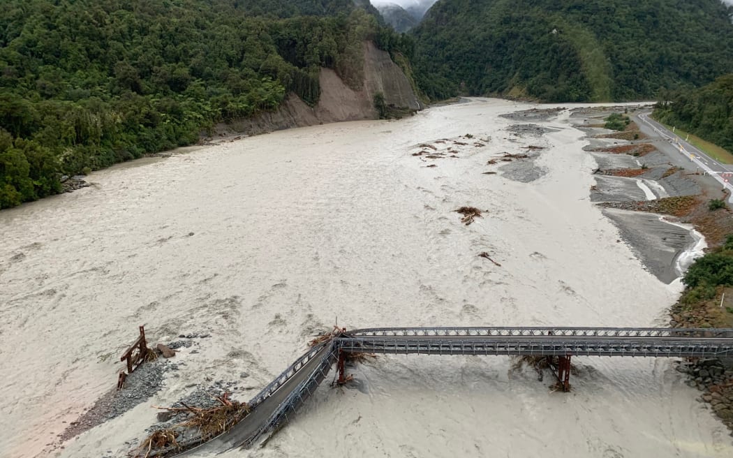
The ruined State highway 6 bridge at Franz Josef following the weather event of March 2019 - the 18-19 January 2024 red warning predicted similar amounts to the 2019 event which saw the bridge washed away. Photo: Wayne Costello / DOC
MetService head of weather communication Lisa Murray said MetService took its role seriously and strove to give the most accurate and timely forecasts.
This included accessing all leading global weather models to collate a broad view, she said.
For the red and orange alerts on 18-19 January and on 25-26 January, MetService had worked closely with the regional council, and it had a close ongoing relationship.
However, all weather models had "strengths and limitations" - one limitation being the "complex topography" of New Zealand.
"MetService high resolution models make improvements over this limitation, however, as is with the nature of forecasting, it is not a perfect science," Murray said.
MetService had liaised closely with West Coast local authorities, including the regional council's hydrology team, before issuing the red alert, after gleaning local insight on the impact the forecast rain amount "could have".
"As there was good consensus in the weather models, it was agreed that this could result in a significant event."
"Rainfall amounts, over the 47 hours covered by the red warning for Westland, were very similar to the March 2019 West Coast event which had large impacts on the region, including the collapse of the Waiho River bridge, and damage to sections of State Highway 6."
The increased risk to an influx of summer tourists into the district was a prime consideration, Murray said.
Local Democracy Reporting is Public Interest Journalism funded through NZ On Air

